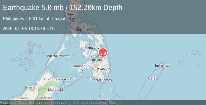
Earthquake 5 km S of Dinagat, Philippines
Thu, 05 Feb 2026 18:15:50 GMT
Time2 hours ago
Location
9.9051, 125.5920
Depth
152.2 KM
Event Summary
A 5.0 magnitude earthquake struck on 5 km S of Dinagat, Philippines, at Thu, 05 Feb 2026 18:15:50 GMT. Depth: 152.224km. Reviewed by USGS seismologists, this moderate quake occurred at a magnitude type of mb.
Magnitude
5.0
mb
Source
USGS
Intensity
-
Agency Reports
1 Sources| Source | Magnitude | Depth | Time |
|---|---|---|---|
| USGSPrimary | 5.0 | 152 km | 2 hours ago |
Earthquake Details
ConfirmedEvent IDusgs_us6000s6q8
Tsunami PotentialNo
Magnitude Typemb
Nearest Places
- Hanigad Island1.9 km
- Zaragoza2.1 km
- Sibale Island2.5 km
- Lagunde Bay2.8 km
- Awasan Bay3.3 km
Comments
Join the discussion about this event.
Latest Earthquakes
1.9Mag
50 km SSW of Skwentna, Alaska
Time2 hours ago
Depth110.00 km
SourceUSGS (Automatic)
2.4Mag
Flores Sea
Time2 hours ago
Depth23.21 km
SourceBMKG (Automatic)
4.0Mag
CENTRAL PERU
Time2 hours ago
Depth117.00 km
SourceLIM (Automatic)
3.9Mag
ALBANIA
Time2 hours ago
Depth15.00 km
SourceIGEO (Automatic)
1.7Mag
12 km SW of Searles Valley, CA
Time2 hours ago
Depth6.44 km
SourceUSGS (Automatic)
Nearby Earthquakes
3.4Mag
PHILIPPINE ISLANDS REGION
Time1 week ago
Depth22.00 km
SourcePIVS (Automatic)
3.0Mag
LEYTE, PHILIPPINES
Time2 weeks ago
Depth4.00 km
SourcePIVS (Automatic)
3.3Mag
LEYTE, PHILIPPINES
Time3 days ago
Depth1.00 km
SourcePIVS (Automatic)
1.4Mag
Mindanao, Philippines
Time3 days ago
Depth33.00 km
SourceMAN (Automatic)
4.0Mag
PHILIPPINE ISLANDS REGION
Time4 days ago
Depth10.00 km
SourcePIVS (Automatic)