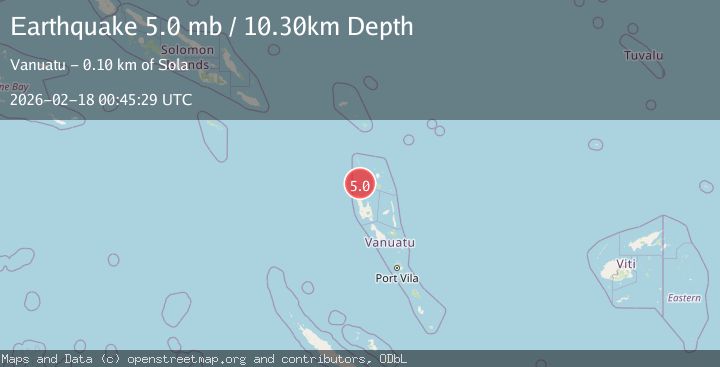
Earthquake 48 km NW of Port-Olry, Vanuatu
Wed, 18 Feb 2026 00:45:37 GMT
Time5 days ago
Location
-14.7448, 166.7454
Depth
10.0 KM
Event Summary
A 5.0 magnitude earthquake struck on 48 km NW of Port-Olry, Vanuatu, at Wed, 18 Feb 2026 00:45:37 GMT. Depth: 10km. Reviewed by USGS seismologists, this moderate quake occurred at a magnitude type of mb.
Magnitude
5.0
mb
Source
USGS
Intensity
-
Agency Reports
3 Sources| Source | Magnitude | Depth | Time |
|---|---|---|---|
| USGSPrimary | 5.0 | 10 km | 5 days ago |
| NEIC | 5.0 | 10 km | 5 days ago |
| EMSC | 5.0 | 10 km | 5 days ago |
Earthquake Details
ConfirmedEvent IDusgs_us6000s9we
Tsunami PotentialNo
Magnitude Typemb
Nearest Places
- 6.5 km
- 6.5 km
- 6.5 km
- 6.7 km
- 6.7 km
Comments
Join the discussion about this event.
Latest Earthquakes
3.1Mag
Fox Islands, Aleutian Islands, Alaska
Time1 minute ago
Depth29.05 km
SourceVYT (Automatic)
3.0Mag
ATACAMA, CHILE
Time4 minutes ago
Depth103.80 km
SourceCSN (Automatic)
2.4Mag
Fox Islands, Aleutian Islands, Alaska
Time5 minutes ago
Depth0.00 km
SourceVYT (Automatic)
1.0Mag
4 km W of Cobb, CA
Time8 minutes ago
Depth2.31 km
SourceUSGS (Automatic)
2.4Mag
Antofagasta, Chile
Time8 minutes ago
Depth77.15 km
SourceVYT (Automatic)
Nearby Earthquakes
5.2Mag
VANUATU
Time9 years ago
Depth40.00 km
SourceEMSC (Automatic)
5.2Mag
VANUATU
Time3 years ago
Depth10.00 km
SourceEMSC (Automatic)
5.8Mag
VANUATU
Time3 years ago
Depth25.00 km
SourceEMSC (Automatic)
6.5Mag
Vanuatu
Time1 week ago
Depth137.08 km
SourceVYT (Automatic)
5.6Mag
VANUATU
Time2 months ago
Depth20.00 km
SourceEMSC (Automatic)