Earthquake 189 km S of Bengkulu, Indonesia
Sat, 27 Dec 2025 01:10:11 GMT
Time3 hours ago
Location
-5.5079, 102.3468
Depth
10.0 KM
Event Summary
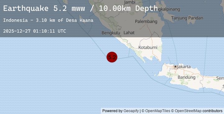
A 5.2 magnitude earthquake struck on 189 km S of Bengkulu, Indonesia, at Sat, 27 Dec 2025 01:10:11 GMT. Depth: 10km. Reviewed by USGS seismologists, this moderate quake occurred at a magnitude type of mww.
Magnitude
5.2
mww
Source
USGS
Intensity
-
Earthquake Details
ConfirmedEvent IDusgs_us7000rkzt
Tsunami PotentialNo
Magnitude Typemww
Nearest Places
- Tanjung Kahoabi4.8 km
- Koho Nanuoea5.3 km
- Desa Kahyapu5.7 km
- Teluk Labuho5.9 km
- Teluk Kiowa6.1 km
Comments
Join the discussion about this event.
Latest Earthquakes
3.3Mag
Northern Sumatra, Indonesia
Time17 minutes ago
Depth16.27 km
SourceBMKG (Automatic)
3.3Mag
NIAS REGION, INDONESIA
Time17 minutes ago
Depth16.00 km
SourceEMSC (Automatic)
2.8Mag
South of Bali, Indonesia
Time20 minutes ago
Depth37.31 km
SourceBMKG (Automatic)
2.8Mag
SOUTH OF BALI, INDONESIA
Time20 minutes ago
Depth37.00 km
SourceEMSC (Automatic)
1.9Mag
13 km E of Puebla, B.C., MX
Time26 minutes ago
Depth18.11 km
SourceUSGS (Automatic)
Nearby Earthquakes
4.6Mag
Southern Sumatra, Indonesia
Time1 hour ago
Depth17.05 km
SourceBMKG (Automatic)
4.9Mag
187 km S of Bengkulu, Indonesia
Time1 hour ago
Depth10.00 km
SourceUSGS
4.9Mag
SOUTHERN SUMATRA, INDONESIA
Time1 hour ago
Depth10.00 km
SourceEMSC (Automatic)
2.9Mag
SOUTHERN SUMATRA, INDONESIA
Time2 hours ago
Depth10.00 km
SourceEMSC (Automatic)
2.9Mag
Southern Sumatra, Indonesia
Time2 hours ago
Depth24.66 km
SourceBMKG (Automatic)