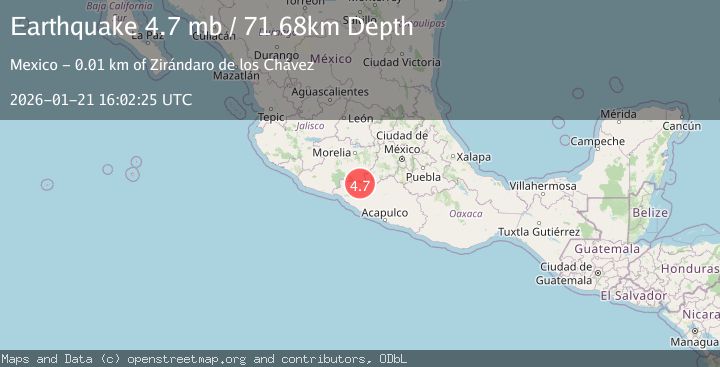
Earthquake 7 km S of Zirándaro de los Chávez, Mexico
Wed, 21 Jan 2026 16:02:25 GMT
Time5 days ago
Location
18.4057, -100.9719
Depth
71.7 KM
Event Summary
A 4.7 magnitude earthquake struck on 7 km S of Zirándaro de los Chávez, Mexico, at Wed, 21 Jan 2026 16:02:25 GMT. Depth: 71.684km. Reviewed by USGS seismologists, this light quake occurred at a magnitude type of mb.
Magnitude
4.7
mb
Source
USGS
Intensity
-
Agency Reports
1 Sources| Source | Magnitude | Depth | Time |
|---|---|---|---|
| USGSPrimary | 4.7 | 72 km | 5 days ago |
Earthquake Details
ConfirmedEvent IDusgs_us7000rr4h
Tsunami PotentialNo
Magnitude Typemb
Nearest Places
- Paso las Piedras1.1 km
- Paso del Negro1.1 km
- La Fragua1.2 km
- Los Anonos1.4 km
- Los Anonos1.4 km
Comments
Join the discussion about this event.
Latest Earthquakes
2.4Mag
Java, Indonesia
Time17 hours ago
Depth5.00 km
SourceBMKG (Automatic)
1.6Mag
2 km NE of Grand Terrace, CA
Time17 hours ago
Depth12.58 km
SourceUSGS (Automatic)
3.7Mag
TARAPACA, CHILE
Time17 hours ago
Depth113.00 km
SourceCSN (Automatic)
2.1Mag
NORTHERN ITALY
Time17 hours ago
Depth8.80 km
SourceETHZ (Automatic)
1.4Mag
20 km N of Indio, CA
Time17 hours ago
Depth2.60 km
SourceUSGS (Automatic)
Nearby Earthquakes
4.1Mag
GUERRERO, MEXICO
Time2 days ago
Depth12.50 km
SourceUNM (Automatic)
4.1Mag
GUERRERO, MEXICO
Time3 days ago
Depth5.00 km
SourceUNM (Automatic)
4.2Mag
OFFSHORE MICHOACAN, MEXICO
Time2 days ago
Depth7.90 km
SourceUNM (Automatic)
4.0Mag
OFFSHORE GUERRERO, MEXICO
Time4 days ago
Depth10.50 km
SourceUNM (Automatic)
4.1Mag
JALISCO, MEXICO
Time2 days ago
Depth104.60 km
SourceUNM (Automatic)