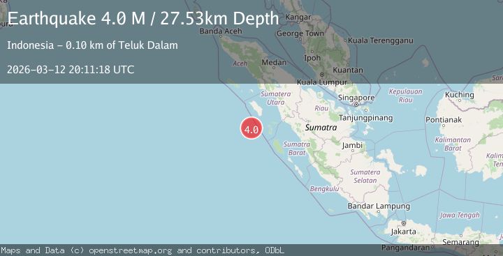
Earthquake southwest of Sumatra, Indonesia
Thu, 12 Mar 2026 20:11:14 GMT
Time3 weeks ago
Location
-0.2859, 97.0891
Depth
10.0 KM
Event Summary
A 4.0 magnitude earthquake struck on southwest of Sumatra, Indonesia, at Thu, 12 Mar 2026 20:11:14 GMT. Depth: 10km. Reviewed by VYT seismologists, this minor quake occurred at a magnitude type of M.
Magnitude
4.0
M
Source
VYT
Intensity
I
Agency Reports
2 Sources| Source | Magnitude | Depth | Time |
|---|---|---|---|
| VYTPrimary | 4.0 | 10 km | 3 weeks ago |
| BMKG | 4.0 | 28 km | 3 weeks ago |
Earthquake Details
AutomaticEvent IDvyt_14c270s1a8w4m
QualityB
Tsunami PotentialNo
Magnitude TypeM
Last Update3 weeks ago
Total Stations31
Nearest Places
Possibly felt by: 1.7K
- 124.2 km25.8K people
Felt Reports0
Did you feel this earthquake? Report it to help others.
No reports yet
Be the first to report this earthquake!
Latest Earthquakes
Loading...
Nearby Earthquakes
3.0Mag
Southwest of Sumatra, Indonesia
Time1 day ago
Depth21.24 km
SourceBMKG
4.9Mag
northern Sumatra, Indonesia
Time2 days ago
Depth36.50 km
SourceVYT (Automatic)
3.1Mag
NIAS REGION, INDONESIA
Time1 week ago
Depth10.00 km
SourceBMKG (Automatic)
3.5Mag
off the west coast of northern Sumatra
Time2 weeks ago
Depth79.35 km
SourceVYT (Automatic)
3.3Mag
off the west coast of northern Sumatra
Time3 weeks ago
Depth11.84 km
SourceVYT (Automatic)