Earthquake Timor Sea
Fri, 20 Feb 2026 07:49:51 GMT
Time2 hours ago
Location
-11.8850, 129.6699
Depth
348.8 KM
Event Summary
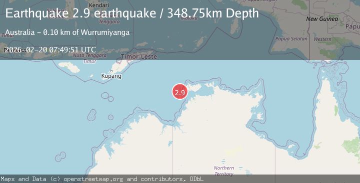
A 2.9 magnitude earthquake struck on Timor Sea, at Fri, 20 Feb 2026 07:49:51 GMT. Depth: 348.7548828125km. Reviewed by VYT seismologists, this minor quake occurred at a magnitude type of earthquake.
Magnitude
2.9
earthquake

Source
VYT
Intensity
-
Agency Reports
1 Sources| Source | Magnitude | Depth | Time |
|---|---|---|---|
| VYTPrimary | 2.9 | 349 km | 2 hours ago |
Earthquake Details
AutomaticEvent IDvyt_14nqsf671o9mw
Tsunami PotentialNo
Magnitude Typeearthquake
Nearest Places
- Shepparton Shoal30.8 km
- Flat Top Bank37.7 km
- Cape Fourcroy39.4 km
- Cleft Point40.3 km
- Harlock Point40.8 km
Comments
Join the discussion about this event.
Latest Earthquakes
2.7Mag
Antofagasta, Chile
Time2 minutes ago
Depth77.88 km
SourceVYT (Automatic)
2.0Mag
Mendoza, Argentina
Time4 minutes ago
Depth7.20 km
SourceVYT (Automatic)
4.2Mag
Kepulauan Talaud, Indonesia
Time11 minutes ago
Depth85.57 km
SourceVYT (Automatic)
2.1Mag
STRAIT OF GIBRALTAR
Time11 minutes ago
Depth1.30 km
SourceIGN (Automatic)
2.0Mag
Antofagasta, Chile
Time14 minutes ago
Depth127.32 km
SourceVYT (Automatic)
Nearby Earthquakes
3.0Mag
NORTHERN TERRITORY, AUSTRALIA
Time10 years ago
Depth20.00 km
SourceAUST (Automatic)
3.7Mag
Northern Territory, Australia
Time3 days ago
Depth169.80 km
SourceVYT (Automatic)
4.3Mag
Timor Sea
Time1 week ago
Depth51.76 km
SourceVYT (Automatic)
2.5Mag
south of Timor
Time1 week ago
Depth646.48 km
SourceVYT (Automatic)
2.9Mag
Northern Territory, Australia
Time1 day ago
Depth54.08 km
SourceVYT (Automatic)