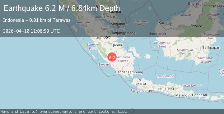
Earthquake southern Sumatra, Indonesia
Fri, 10 Apr 2026 11:08:50 GMT
Low Quality Data Warning
This earthquake may be wrong/incorrect, it is recommended not to spread this information because there is a possibility that further updates are needed for data accuracy.
Time2 weeks ago
Location
-2.9641, 102.8704
Depth
6.8 KM
Event Summary
A 6.2 magnitude earthquake struck on southern Sumatra, Indonesia, at Fri, 10 Apr 2026 11:08:50 GMT. Depth: 6.8359375km. Reviewed by VYT seismologists, this strong quake occurred at a magnitude type of M.
Magnitude
6.2
M
Source
VYT
Intensity
VII
Agency Reports
5 Sources| Source | Magnitude | Depth | Time |
|---|---|---|---|
| VYTPrimary | 6.2 | 7 km | 2 weeks ago |
| BMKG | 5.5 | 106 km | 2 weeks ago |
| EMSC | 5.4 | 169 km | 2 weeks ago |
| NEIC | 5.1 | 107 km | 2 weeks ago |
| USGS | 5.1 | 107 km | 2 weeks ago |
Earthquake Details
AutomaticEvent IDvyt_1h0ylnmmgj2wj
QualityD
Tsunami PotentialNo
Magnitude TypeM
Last Update2 weeks ago
Used Stations70
Total Stations575
Nearest Places
Possibly felt by: 5.1M
- VIITerawas11.6 km
- 27.1 km
- 36.5 km
- 36.8 km234.2K people
- 39.8 km
- 46.4 km
- 46.8 km
- 49.5 km
- 68.1 km
- 68.4 km46.2K people
- 72.7 km
- 74.2 km
- 76.4 km
- 82.7 km
- 86.3 km
- 88.2 km
- IVBabat89.1 km
- 91.3 km
- IVPauh92.0 km
- 98.9 km
- 100.5 km
- 100.6 km
- IVJangkat103.9 km
- IVSekayu107.4 km
- IVLais110.7 km
- 111.2 km
- IVBengkulu114.7 km373.6K people
- 115.0 km
- IVLahat117.9 km65.9K people
- IVBangko119.6 km
- 123.4 km
- IVKetahun124.3 km
- 124.5 km
- 125.2 km70.4K people
- 125.7 km
- 125.8 km
- IVTais127.8 km
- 131.3 km
- 134.8 km
- 135.6 km
- 135.6 km
- 137.7 km
- 139.3 km
- 139.4 km8K people
- IVMersam141.5 km
- 142.0 km
- IIIMuara Bulian145.6 km
- IIISuban Jeriji149.3 km
- IIITanjungagung149.9 km53.1K people
- IIIIpuh154.1 km
- IIISungairotan157.1 km
- IIIMasat157.8 km
- IIIPrabumulih159.8 km103.5K people
- IIIPengandonan164.8 km
- IIIManna166.9 km
- 169.5 km
- IIIMuara Tebo172.1 km
- IIIJambi City172.9 km606.2K people
- IIIGlumbang176.6 km
- IIISekernan177.9 km
- IIISengeti179.9 km
- IIIPadangguci183.2 km
- IIIMuara Bungo184.1 km21.2K people
- 190.8 km
- IIISungai Penuh192.8 km97.8K people
- IIIBaturaja193.6 km134.8K people
- IIIPeninjawan195.7 km
- IIISemurup198.8 km
- IIIMukomuko200.2 km
- IIITalangbetutu202.7 km
- IIIIndralaya203.0 km
- 203.5 km
- 203.7 km
- IIIMuarakuang203.9 km
- IIISiulak204.8 km
- 205.6 km
- IIIPalembang208.3 km1.7M people
- IIIBintuhan210.2 km
- 211.1 km
- IIITanjungraja215.4 km
- IIICempaka217.0 km
- 218.8 km
- IIIMuara Dua219.6 km
- IIISungaigerong219.6 km
- IIISimpang220.8 km
- IIIMartapura222.6 km
- IIIKayu Agung222.8 km
- 223.4 km
- IIIPedamaran226.0 km
- IIIMuara Sabak230.6 km
- IIIMendaha231.0 km56.3K people
- IIISimpang233.0 km36.7K people
- IIISungsang235.5 km
- 236.2 km
- IIILubukgadang238.9 km
- IIIPadang Aro239.6 km
- IIIKotabaru241.1 km
- 247.7 km33.7K people
- 250.5 km
- IIIKuripan250.8 km
- 255.6 km
- 256.4 km
- 261.3 km
- IIKasui262.0 km
- 264.6 km
- IILiwa266.3 km
- 267.8 km
- IIKenali269.0 km
- 269.4 km
- 270.0 km
- IIMuntok273.4 km26.7K people
- IIKrui274.2 km
- IIEnok274.8 km
- 277.6 km
- IIKambang277.6 km
- 279.7 km
- 281.3 km
- 283.1 km
- IIPeranap286.5 km
- IIKetapang289.2 km
- IIRengat290.1 km
- IISurian291.4 km
- IIBiha292.8 km
- IIOganlima293.5 km
- IICerenti294.9 km
- 295.5 km
- 295.5 km
- 297.5 km
- IISapat297.7 km
- 299.4 km
- 300.7 km
- 301.8 km
- IIKotabumi304.3 km42.4K people
- IITeritip304.8 km
- 305.9 km
- 306.4 km
- IIBaserah306.7 km
- 307.1 km
- IIPainan311.9 km
- 312.1 km
- IIMenggala312.9 km
- 314.1 km
- IIJebus317.7 km
- 320.7 km
- 328.0 km27.8K people
- IISirukam329.2 km
- IIMuaro332.5 km
- 333.9 km
- 334.0 km
- IIKelapa334.3 km
- IIArosuka335.4 km
- 336.4 km52.6K people
- 338.4 km
- 339.2 km
- 339.9 km
- 341.0 km
- 341.9 km
- IIKalirejo342.1 km
- 342.9 km
- IISolok344.1 km73.4K people
- 344.1 km
- 344.1 km
- 345.7 km
- 349.9 km
- IIKumanis351.4 km
- IIPunggur353.0 km
- 353.5 km
- 354.0 km
- IITalawi354.0 km
- 355.2 km
- 356.9 km
- IIPadang358.3 km909K people
- IISulitair359.7 km
- 360.0 km
- IIMetro360.7 km168.6K people
- 361.6 km
- 362.2 km
- 362.9 km
- 364.7 km
- IITabing364.7 km
- 365.0 km
- IINatar366.5 km
- 368.5 km
- IISurabaya369.3 km
- IISaruaso371.1 km
- 371.6 km
- 372.1 km216.9K people
- 373.0 km
- 374.9 km
- IIRambatan377.3 km
- IIKedaton377.6 km
- IISukadana377.9 km
- IITuapejat379.0 km5.8K people
- 379.2 km
- 380.3 km
- 380.5 km
- IISimabur380.8 km
- 381.3 km1.2M people
- 381.7 km100.8K people
- 382.9 km
- 386.3 km
- IISenayang388.2 km
- 388.4 km
- 388.5 km
- IIPanjang389.6 km
- 390.2 km
- 391.3 km
- 391.3 km
- 393.9 km139.6K people
- 395.6 km
- 396.4 km
- IIKoba396.4 km
- 397.5 km
- IIJepara398.7 km
- IIBaso401.5 km
- IIPariaman401.8 km92.2K people
- IIKotatua403.1 km
- 403.2 km
- 405.4 km121K people
- 406.2 km
- IIGuguk406.3 km
- 408.2 km
- IIKepoh409.4 km
- IISidorejo414.1 km
- 414.1 km
- IIMatur414.2 km
- IISawang415.1 km
- 416.4 km
- 417.2 km
- 418.4 km1.1M people
- 420.3 km
- 420.7 km
- IMoro423.8 km
- 426.0 km
- 427.6 km
- 428.2 km
- 431.4 km
- 431.7 km
- 434.0 km
- ITiku434.6 km
- 438.8 km
- 440.0 km
- 440.5 km
- 442.2 km
- 444.0 km
- 445.0 km49K people
- 448.6 km
- 457.9 km
- 458.1 km
- 466.2 km227.7K people
- 469.8 km
- 471.3 km
- 475.1 km1.2M people
- 477.3 km
- ITalu478.8 km
- 478.9 km
- 480.2 km
- 480.6 km56.5K people
- 481.3 km
- 484.1 km
- 484.5 km
- 484.7 km95.9K people
- 485.4 km5.6M people
- 486.5 km
- 487.3 km262.7K people
- 488.3 km46.4K people
- 489.4 km
- 489.5 km110.2K people
- 497.1 km147.1K people
- 497.1 km
- 498.3 km50.8K people
- 499.4 km
- 500.0 km254.7K people
- 500.3 km174.4K people
- 501.7 km33.6K people
- 501.9 km
- 502.3 km858.1K people
- 502.6 km23.3K people
- 504.5 km
- 505.2 km692.1K people
- 505.2 km
- 505.6 km
- 505.9 km145.6K people
- IDuri506.9 km
- 507.8 km
- 507.9 km
- 508.1 km159.7K people
- 508.2 km
- 509.1 km
- 510.0 km
- 512.3 km
- 513.0 km
- 514.8 km73.2K people
- 514.9 km
- 515.2 km
- 515.5 km
- 516.5 km
- 516.6 km
- 516.6 km92.3K people
- 517.0 km
- 517.6 km
- 518.3 km75.3K people
- 518.9 km
- 520.2 km63.8K people
- 520.5 km13.2K people
- 520.6 km
- 521.9 km
- 523.9 km
- 524.7 km110.2K people
- 526.2 km
- 528.2 km
- 529.7 km103.1K people
- 531.1 km
- 531.7 km137K people
- 534.5 km
- 535.0 km17.5K people
- 535.2 km52.7K people
- 535.3 km
- 535.7 km
- 535.9 km156.2K people
- 536.2 km
- 538.0 km17.4K people
- 538.9 km143.8K people
- 539.7 km
- 540.0 km273.7K people
- 540.0 km118.4K people
- 541.4 km
- 542.9 km
- 543.0 km
- 543.1 km174K people
- 543.5 km
- 543.9 km128.3K people
- 546.5 km
- 548.9 km1.9M people
- 549.2 km191.4K people
- 549.6 km
- 549.6 km
- 550.8 km
- 550.8 km
- 552.2 km
- 553.9 km27.1K people
- 555.1 km
- 557.4 km30.3K people
- 557.6 km169.8K people
- IMuar557.9 km127.9K people
- 558.7 km207.9K people
- 561.9 km80.2K people
- 563.1 km
- 563.3 km
- 564.3 km1.4M people
- 567.0 km
- 569.8 km8.5M people
- 570.0 km174.6K people
- 572.3 km
- 573.2 km
- 575.3 km123.1K people
- 576.0 km
- 577.4 km165.6K people
- 578.0 km579K people
- 578.3 km
- 578.9 km15.5K people
- 579.6 km55.7K people
- 580.0 km11.8K people
- 580.2 km
- 580.8 km2.1M people
- 581.1 km38.6K people
- 582.7 km207.2K people
- 582.8 km35.1K people
- 583.7 km2.6M people
- 583.8 km25K people
- 584.4 km14.3K people
- 585.2 km37.7K people
- 585.8 km17.4K people
- 587.5 km26K people
- 589.8 km363.4K people
- 592.3 km288.3K people
- 592.4 km214.7K people
- 592.8 km1.1M people
- 594.5 km
- 595.0 km21.9K people
- 595.7 km
- 596.8 km29.2K people
- 598.8 km20.2K people
- 599.2 km12.3K people
- 599.3 km39.1K people
- 599.7 km106.5K people
- 603.9 km91.8K people
- 605.3 km109.5K people
- 605.8 km201.5K people
- 606.6 km89K people
- 606.7 km11.9K people
- 608.4 km28.2K people
- 609.3 km69.8K people
- 609.5 km22K people
- 610.0 km
- 613.6 km
- 613.6 km13.1K people
- 613.8 km
- 614.7 km
- 617.4 km
- 621.9 km89.2K people
- 621.9 km
- 623.4 km
- 627.1 km225.1K people
- 627.6 km
- 628.6 km276.4K people
- 629.8 km
- 631.8 km
- 633.1 km
- 635.6 km
- 637.0 km145.6K people
- 637.7 km13.8K people
- 637.9 km19.5K people
- 638.5 km174.6K people
- 639.7 km
- 640.6 km
- 641.3 km212.1K people
- 641.5 km372.9K people
- 641.8 km
- 641.8 km22.3K people
- 643.9 km31.3K people
- 644.2 km
- 645.0 km
- 645.2 km179.2K people
- 646.3 km
- 648.0 km77.8K people
- 648.3 km
- 649.2 km
- 650.6 km
- 652.3 km36.7K people
- 652.4 km
Felt Reports0
Did you feel this earthquake? Report it to help others.
No reports yet
Be the first to report this earthquake!
Latest Earthquakes
Loading...
Nearby Earthquakes
2.9Mag
Southern Sumatra, Indonesia
Time2 days ago
Depth178.46 km
SourceBMKG
3.7Mag
southern Sumatra, Indonesia
Time3 days ago
Depth140.87 km
SourceVYT (Automatic)
3.3Mag
Southern Sumatra, Indonesia
Time3 days ago
Depth179.44 km
SourceBMKG
2.7Mag
Southern Sumatra, Indonesia
Time5 days ago
Depth236.85 km
SourceBMKG
2.4Mag
southern Sumatra, Indonesia
Time5 days ago
Depth0.85 km
SourceVYT (Automatic)