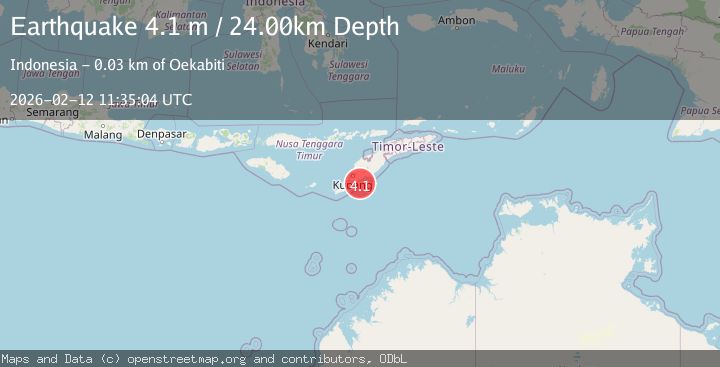
Earthquake Timor region, Indonesia
Thu, 12 Feb 2026 11:34:54 GMT
Low Quality Data Warning
This earthquake may be wrong/incorrect, it is recommended not to spread this information because there is a possibility that further updates are needed for data accuracy.
Time2 months ago
Location
-10.9667, 123.6290
Depth
0.0 KM
Event Summary
A 4.0 magnitude earthquake struck on Timor region, Indonesia, at Thu, 12 Feb 2026 11:34:54 GMT. Depth: 0km. Reviewed by VYT seismologists, this minor quake occurred at a magnitude type of earthquake.
Magnitude
4.0
earthquake
Source
VYT
Intensity
II
Agency Reports
2 Sources| Source | Magnitude | Depth | Time |
|---|---|---|---|
| VYTPrimary | 4.0 | 0 km | 2 months ago |
| BMKG | 4.1 | 24 km | 2 months ago |
Earthquake Details
AutomaticEvent IDvyt_2c5xefstelpx8
QualityD
Tsunami PotentialNo
Magnitude Typeearthquake
Last Update2 months ago
Total Stations4
Nearest Places
Possibly felt by: 48.1K
Felt Reports0
Did you feel this earthquake? Report it to help others.
No reports yet
Be the first to report this earthquake!