Earthquake south of the Kermadec Islands
Fri, 13 Mar 2026 16:15:40 GMT
Time0 months ago
Location
-34.0185, 179.5236
Depth
278.1 KM
Event Summary
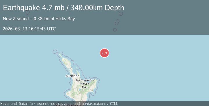
A 4.7 magnitude earthquake struck on south of the Kermadec Islands, at Fri, 13 Mar 2026 16:15:40 GMT. Depth: 278.076171875km. Reviewed by VYT seismologists, this light quake occurred at a magnitude type of M.
Magnitude
4.7
M
Source
VYT
Intensity
-
Agency Reports
4 Sources| Source | Magnitude | Depth | Time |
|---|---|---|---|
| VYTPrimary | 4.7 | 278 km | 0 months ago |
| USGS | 4.7 | 344 km | 0 months ago |
| NEIC | 4.7 | 344 km | 0 months ago |
| EMSC | 4.7 | 340 km | 0 months ago |
Earthquake Details
AutomaticEvent IDvyt_2tsmxzoc4umue
QualityB
Tsunami PotentialNo
Magnitude TypeM
Last Update0 months ago
Total Stations39
Felt Reports0
Did you feel this earthquake? Report it to help others.
No reports yet
Be the first to report this earthquake!
Latest Earthquakes
Loading...
Nearby Earthquakes
4.0Mag
SOUTH OF KERMADEC ISLANDS
Time1 week ago
Depth5.00 km
SourceGNS (Automatic)
4.5Mag
south of the Kermadec Islands
Time1 week ago
Depth136.72 km
SourceVYT (Automatic)
5.2Mag
south of the Kermadec Islands
Time2 weeks ago
Depth10.00 km
SourceVYT (Automatic)
4.4Mag
SOUTH OF KERMADEC ISLANDS
Time1 month ago
Depth114.20 km
SourceNEIC (Automatic)
4.3Mag
SOUTH OF KERMADEC ISLANDS
Time1 month ago
Depth167.50 km
SourceNEIC (Automatic)