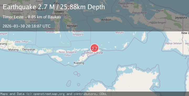
Earthquake Timor region, Indonesia
Mon, 30 Mar 2026 20:18:07 GMT
Low Quality Data Warning
This earthquake may be wrong/incorrect, it is recommended not to spread this information because there is a possibility that further updates are needed for data accuracy.
Time1 week ago
Location
-8.1020, 126.2241
Depth
25.9 KM
Event Summary
A 2.7 magnitude earthquake struck on Timor region, Indonesia, at Mon, 30 Mar 2026 20:18:07 GMT. Depth: 25.87890625km. Reviewed by VYT seismologists, this minor quake occurred at a magnitude type of M.
Magnitude
2.7
M
Source
VYT
Intensity
-
Agency Reports
1 Sources| Source | Magnitude | Depth | Time |
|---|---|---|---|
| VYTPrimary | 2.7 | 26 km | 1 week ago |
Earthquake Details
AutomaticEvent IDvyt_2ultxm2asih7m
QualityD
Tsunami PotentialNo
Magnitude TypeM
Last Update1 week ago
Used Stations9
Total Stations9
Felt Reports0
Did you feel this earthquake? Report it to help others.
No reports yet
Be the first to report this earthquake!
Latest Earthquakes
Loading...
Nearby Earthquakes
2.8Mag
Timor Region
Time5 days ago
Depth10.00 km
SourceBMKG
4.0Mag
KEPULAUAN BARAT DAYA, INDONESIA
Time2 weeks ago
Depth378.00 km
SourceBMKG (Automatic)
3.1Mag
Timor region, Indonesia
Time2 weeks ago
Depth480.35 km
SourceVYT (Automatic)
2.9Mag
Banda Sea
Time2 weeks ago
Depth216.46 km
SourceBMKG
3.4Mag
Timor Region
Time1 month ago
Depth92.61 km
SourceBMKG