Earthquake southern Sumatra, Indonesia
Sun, 01 Mar 2026 22:07:22 GMT
Time1 hour ago
Location
-5.4395, 103.1743
Depth
8.9 KM
Event Summary
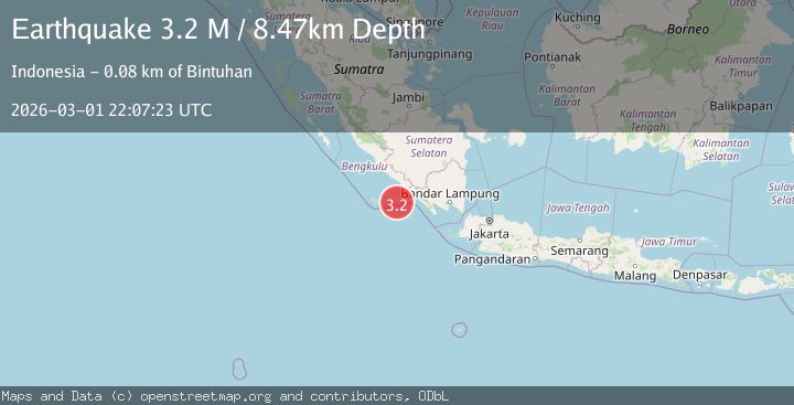
A 3.2 magnitude earthquake struck on southern Sumatra, Indonesia, at Sun, 01 Mar 2026 22:07:22 GMT. Depth: 8.9111328125km. Reviewed by VYT seismologists, this minor quake occurred at a magnitude type of earthquake.
Magnitude
3.2
earthquake
Source
VYT
Intensity
-
Agency Reports
2 Sources| Source | Magnitude | Depth | Time |
|---|---|---|---|
| VYTPrimary | 3.2 | 9 km | 1 hour ago |
| BMKG | 3.2 | 8 km | 1 hour ago |
Earthquake Details
AutomaticEvent IDvyt_2v31p2fweq0tw
Tsunami PotentialNo
Magnitude Typeearthquake
Nearest Places
- 69.4 km
- 69.9 km
- 70.5 km
- 70.5 km
- 70.9 km
Comments
Join the discussion about this event.
Latest Earthquakes
2.8Mag
Antofagasta, Chile
Time4 minutes ago
Depth0.00 km
SourceVYT (Automatic)
1.1Mag
2 km SE of Aromas, CA
Time6 minutes ago
Depth3.43 km
SourceUSGS (Automatic)
2.4Mag
WESTERN TURKEY
Time7 minutes ago
Depth3.30 km
SourceKOERI (Automatic)
3.3Mag
Salta, Argentina
Time7 minutes ago
Depth353.27 km
SourceVYT (Automatic)
1.2Mag
Alaska Peninsula
Time10 minutes ago
Depth0.00 km
SourceVYT (Automatic)
Nearby Earthquakes
4.0Mag
SOUTHERN SUMATRA, INDONESIA
Time1 year ago
Depth18.00 km
SourceBMKG (Automatic)
3.0Mag
SOUTHERN SUMATRA, INDONESIA
Time3 months ago
Depth10.00 km
SourceBMKG (Automatic)
3.7Mag
Southern Sumatra, Indonesia
Time4 days ago
Depth46.00 km
SourceBMKG
4.0Mag
SOUTHERN SUMATRA, INDONESIA
Time4 years ago
Depth26.00 km
SourceDJA (Automatic)
5.2Mag
SOUTHERN SUMATRA, INDONESIA
Time2 months ago
Depth10.00 km
SourceBMKG (Automatic)