Earthquake near the north coast of Papua, Indonesia
Wed, 11 Feb 2026 21:30:48 GMT
Time1 week ago
Location
-2.2332, 140.2690
Depth
0.0 KM
Event Summary
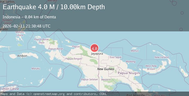
A 4.0 magnitude earthquake struck on near the north coast of Papua, Indonesia, at Wed, 11 Feb 2026 21:30:48 GMT. Depth: 0km. Reviewed by VYT seismologists, this light quake occurred at a magnitude type of earthquake.
Magnitude
4.0
earthquake
Source
VYT
Intensity
-
Agency Reports
2 Sources| Source | Magnitude | Depth | Time |
|---|---|---|---|
| VYTPrimary | 3.6 | 0 km | 1 week ago |
| BMKG | 4.0 | 10 km | 1 week ago |
Earthquake Details
AutomaticEvent IDvyt_3cdhhpfq4varx
Tsunami PotentialNo
Magnitude Typeearthquake
Nearest Places
- Salean Segara15.1 km
- Tanjung Korongwan17.3 km
- Muris Kecil17.3 km
- Pulau Besar17.3 km
- Kampung Yougapsa17.5 km
Comments
Join the discussion about this event.
Latest Earthquakes
1.6Mag
13 km ENE of Falls City, Texas
Time11 hours ago
Depth7.18 km
SourceUSGS (Automatic)
1.5Mag
EASTERN TURKEY
Time11 hours ago
Depth7.00 km
SourceAFAD (Automatic)
1.3Mag
5 km S of Cabazon, CA
Time11 hours ago
Depth5.80 km
SourceUSGS (Automatic)
2.1Mag
Antofagasta, Chile
Time11 hours ago
Depth131.23 km
SourceVYT (Automatic)
2.3Mag
Sulawesi, Indonesia
Time11 hours ago
Depth2.74 km
SourceBMKG
Nearby Earthquakes
3.0Mag
NEAR N COAST OF PAPUA, INDONESIA
Time1 year ago
Depth10.00 km
SourceBMKG (Automatic)
3.0Mag
NEAR N COAST OF PAPUA, INDONESIA
Time4 years ago
Depth11.00 km
SourceDJA (Automatic)
5.3Mag
NEAR N COAST OF PAPUA, INDONESIA
Time9 years ago
Depth10.00 km
SourceEMSC (Automatic)
4.0Mag
NEAR N COAST OF PAPUA, INDONESIA
Time1 year ago
Depth10.00 km
SourceBMKG (Automatic)
2.8Mag
NEAR N COAST OF PAPUA, INDONESIA
Time1 month ago
Depth5.00 km
SourceBMKG (Automatic)