Earthquake Kepulauan Sula, Indonesia
Fri, 27 Mar 2026 20:19:32 GMT
Time2 days ago
Location
-0.2891, 125.2318
Depth
10.0 KM
Event Summary
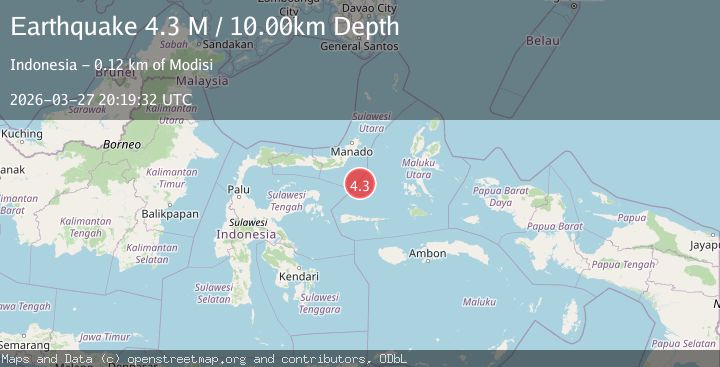
A 4.3 magnitude earthquake struck on Kepulauan Sula, Indonesia, at Fri, 27 Mar 2026 20:19:32 GMT. Depth: 10km. Reviewed by VYT seismologists, this light quake occurred at a magnitude type of M.
Magnitude
4.3
M
Source
VYT
Intensity
I
Agency Reports
2 Sources| Source | Magnitude | Depth | Time |
|---|---|---|---|
| VYTPrimary | 4.3 | 10 km | 2 days ago |
| BMKG | 4.3 | 10 km | 2 days ago |
Earthquake Details
AutomaticEvent IDvyt_3e3tn4vuidi7p
QualityC
Tsunami PotentialNo
Magnitude TypeM
Last Update2 days ago
Used Stations60
Total Stations79
Nearest Places
Possibly felt by: 1.1K
- 120.8 km10.4K people
- 135.9 km
- 138.2 km
- 145.8 km
- 146.2 km
- 156.6 km
- 156.9 km
- 157.0 km
- 157.9 km
- 158.1 km
- 159.0 km
- 160.0 km
- 162.2 km
- IDofa168.1 km
Felt Reports0
Did you feel this earthquake? Report it to help others.
No reports yet
Be the first to report this earthquake!
Latest Earthquakes
Loading...
Nearby Earthquakes
3.0Mag
Northern Molucca Sea
Time1 day ago
Depth4.66 km
SourceBMKG
3.5Mag
Kepulauan Sula, Indonesia
Time5 days ago
Depth7.81 km
SourceVYT (Automatic)
3.8Mag
Northern Molucca Sea
Time1 week ago
Depth24.15 km
SourceBMKG
3.0Mag
Minahasa, Sulawesi, Indonesia
Time1 week ago
Depth14.16 km
SourceVYT (Automatic)
4.3Mag
Molucca Sea
Time1 week ago
Depth12.33 km
SourceVYT (Automatic)