Earthquake southern Sumatra, Indonesia
Fri, 10 Apr 2026 10:48:23 GMT
Time1 week ago
Location
-0.1693, 100.1055
Depth
22.9 KM
Event Summary
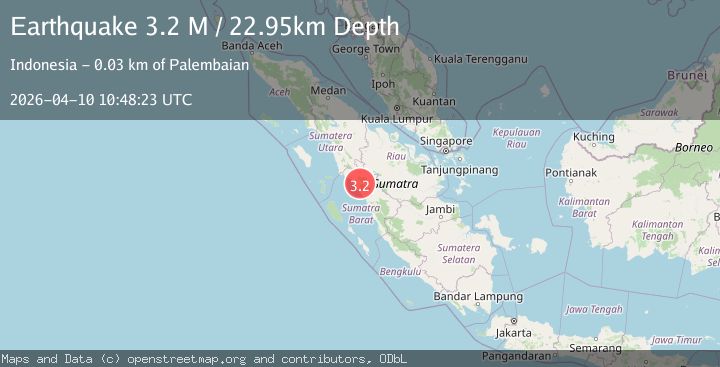
A 3.2 magnitude earthquake struck on southern Sumatra, Indonesia, at Fri, 10 Apr 2026 10:48:23 GMT. Depth: 22.94921875km. Reviewed by VYT seismologists, this minor quake occurred at a magnitude type of M.
Magnitude
3.2
M
Source
VYT
Intensity
II
Agency Reports
2 Sources| Source | Magnitude | Depth | Time |
|---|---|---|---|
| VYTPrimary | 3.2 | 23 km | 1 week ago |
| BMKG | 2.7 | 10 km | 1 week ago |
Earthquake Details
AutomaticEvent IDvyt_3jj570fvnvyqb
QualityC
Tsunami PotentialNo
Magnitude TypeM
Last Update1 week ago
Used Stations19
Total Stations19
Nearest Places
Possibly felt by: 36.1K
- 14.3 km
- 17.9 km
- IIManinjau19.9 km
- IIBonjol21.6 km
- IIMatur23.7 km
- IITiku32.3 km
- 33.3 km121K people
- IIKotatua34.6 km
- 35.5 km
- 38.9 km
- IBaso40.6 km
- 42.1 km
- 43.1 km
- ITalu46.5 km
- 46.9 km
- 49.8 km
- 50.0 km92.2K people
- 53.3 km
- 53.8 km
- 55.4 km
- 57.3 km
- 58.9 km139.6K people
- 59.4 km
- 60.7 km
- 60.8 km
- 60.9 km
- 61.9 km
- 62.1 km
- 63.9 km
- 64.8 km
- 68.7 km
Felt Reports0
Did you feel this earthquake? Report it to help others.
No reports yet
Be the first to report this earthquake!
Latest Earthquakes
Loading...
Nearby Earthquakes
2.5Mag
Northern Sumatra, Indonesia
Time9 hours ago
Depth3.01 km
SourceBMKG
2.9Mag
Southern Sumatra, Indonesia
Time17 hours ago
Depth8.01 km
SourceBMKG
2.8Mag
Northern Sumatra, Indonesia
Time1 day ago
Depth149.86 km
SourceBMKG
2.3Mag
Southern Sumatra, Indonesia
Time1 day ago
Depth0.66 km
SourceBMKG
2.1Mag
southern Sumatra, Indonesia
Time1 week ago
Depth0.00 km
SourceVYT (Automatic)