Earthquake northern Sumatra, Indonesia
Fri, 06 Mar 2026 06:05:59 GMT
Time2 hours ago
Location
4.7965, 98.1343
Depth
0.1 KM
Event Summary
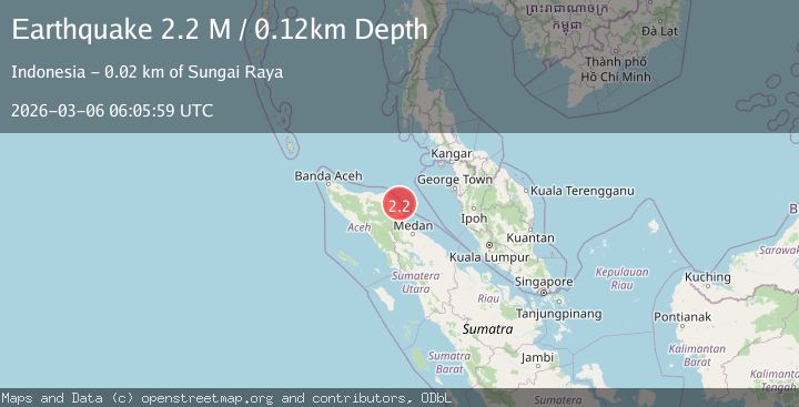
A 2.2 magnitude earthquake struck on northern Sumatra, Indonesia, at Fri, 06 Mar 2026 06:05:59 GMT. Depth: 0.1220703125km. Reviewed by VYT seismologists, this minor quake occurred at a magnitude type of M.
Magnitude
2.2
M
Source
VYT
Intensity
-
Agency Reports
1 Sources| Source | Magnitude | Depth | Time |
|---|---|---|---|
| VYTPrimary | 2.2 | 0 km | 2 hours ago |
Earthquake Details
AutomaticEvent IDvyt_3nmvl5b1ltfhz
Tsunami PotentialNo
Magnitude TypeM
Nearest Places
- 21.4 km
- 21.7 km
- 22.0 km
- 22.2 km
- 22.3 km
Comments
Join the discussion about this event.
Latest Earthquakes
2.0Mag
Finland
Time1 hour ago
Depth0.00 km
SourceVYT (Automatic)
0.9Mag
Southeastern Alaska
Time2 hours ago
Depth0.00 km
SourceVYT (Automatic)
0.7Mag
4 km W of Lake Henshaw, CA
Time2 hours ago
Depth11.78 km
SourceUSGS (Automatic)
2.3Mag
northern Colombia
Time2 hours ago
Depth256.84 km
SourceVYT (Automatic)
2.2Mag
Central California
Time2 hours ago
Depth0.00 km
SourceVYT (Automatic)
Nearby Earthquakes
3.0Mag
NORTHERN SUMATRA, INDONESIA
Time4 years ago
Depth10.00 km
SourceDJA (Automatic)
4.0Mag
NORTHERN SUMATRA, INDONESIA
Time6 years ago
Depth10.00 km
SourceDJA (Automatic)
3.0Mag
NORTHERN SUMATRA, INDONESIA
Time2 years ago
Depth10.00 km
SourceBMKG (Automatic)
5.1Mag
NORTHERN SUMATRA, INDONESIA
Time7 years ago
Depth10.00 km
SourceEMSC (Automatic)
3.0Mag
NORTHERN SUMATRA, INDONESIA
Time2 years ago
Depth10.00 km
SourceDJA (Automatic)