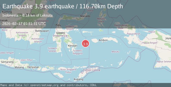
Earthquake Banda Sea
Tue, 17 Feb 2026 01:31:31 GMT
Low Quality Data Warning
This earthquake may be wrong/incorrect, it is recommended not to spread this information because there is a possibility that further updates are needed for data accuracy.
Time2 months ago
Location
-3.9534, 124.9226
Depth
116.7 KM
Event Summary
A 3.9 magnitude earthquake struck on Banda Sea, at Tue, 17 Feb 2026 01:31:31 GMT. Depth: 116.69921875km. Reviewed by VYT seismologists, this minor quake occurred at a magnitude type of earthquake.
Magnitude
3.9
earthquake
Source
VYT
Intensity
-
Agency Reports
1 Sources| Source | Magnitude | Depth | Time |
|---|---|---|---|
| VYTPrimary | 3.9 | 117 km | 2 months ago |
Earthquake Details
AutomaticEvent IDvyt_3nzwem4t3v67w
QualityD
Tsunami PotentialNo
Magnitude Typeearthquake
Last Update2 months ago
Total Stations4
Felt Reports0
Did you feel this earthquake? Report it to help others.
No reports yet
Be the first to report this earthquake!
Latest Earthquakes
Loading...
Nearby Earthquakes
4.3Mag
Banda Sea
Time3 weeks ago
Depth405.27 km
SourceVYT (Automatic)
4.7Mag
Banda Sea
Time1 month ago
Depth10.00 km
SourceVYT
3.3Mag
Banda Sea
Time1 month ago
Depth395.02 km
SourceVYT (Automatic)
4.0Mag
Banda Sea
Time1 month ago
Depth105.96 km
SourceVYT (Automatic)
4.0Mag
BANDA SEA
Time1 year ago
Depth437.00 km
SourceBMKG (Automatic)