Earthquake Kepulauan Aru region, Indonesia
Thu, 19 Feb 2026 12:53:47 GMT
Low Quality Data Warning
This earthquake may be wrong/incorrect, it is recommended not to spread this information because there is a possibility that further updates are needed for data accuracy.
Time1 month ago
Location
-6.6907, 133.7127
Depth
92.0 KM
Event Summary
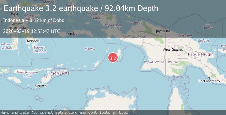
A 3.2 magnitude earthquake struck on Kepulauan Aru region, Indonesia, at Thu, 19 Feb 2026 12:53:47 GMT. Depth: 92.041015625km. Reviewed by VYT seismologists, this minor quake occurred at a magnitude type of earthquake.
Magnitude
3.2
earthquake
Source
VYT
Intensity
-
Agency Reports
1 Sources| Source | Magnitude | Depth | Time |
|---|---|---|---|
| VYTPrimary | 3.2 | 92 km | 1 month ago |
Earthquake Details
AutomaticEvent IDvyt_3r68cfh40qk73
QualityD
Tsunami PotentialNo
Magnitude Typeearthquake
Last Update1 month ago
Total Stations20
Felt Reports0
Did you feel this earthquake? Report it to help others.
No reports yet
Be the first to report this earthquake!
Latest Earthquakes
Loading...
Nearby Earthquakes
3.0Mag
Kepulauan Tanimbar, Indonesia
Time1 month ago
Depth195.07 km
SourceVYT (Automatic)
4.5Mag
Kepulauan Aru region, Indonesia
Time1 month ago
Depth119.51 km
SourceVYT (Automatic)
3.5Mag
KEPULAUAN ARU REGION, INDONESIA
Time1 month ago
Depth10.00 km
SourceBMKG (Automatic)
4.1Mag
KEPULAUAN ARU REGION, INDONESIA
Time2 months ago
Depth88.00 km
SourceBMKG (Automatic)
4.0Mag
KEPULAUAN KAI, INDONESIA
Time3 years ago
Depth30.00 km
SourceDJA (Automatic)