Earthquake Western Australia
Fri, 27 Feb 2026 06:17:10 GMT
Time2 hours ago
Location
-25.6585, 117.3680
Depth
297.6 KM
Event Summary
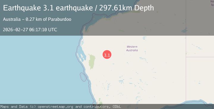
A 3.1 magnitude earthquake struck on Western Australia, at Fri, 27 Feb 2026 06:17:10 GMT. Depth: 297.607421875km. Reviewed by VYT seismologists, this minor quake occurred at a magnitude type of earthquake.
Magnitude
3.1
earthquake
Source
VYT
Intensity
-
Agency Reports
1 Sources| Source | Magnitude | Depth | Time |
|---|---|---|---|
| VYTPrimary | 3.1 | 298 km | 2 hours ago |
Earthquake Details
AutomaticEvent IDvyt_4s99yy255uvf
Tsunami PotentialNo
Magnitude Typeearthquake
Nearest Places
- 5.0 km
- 5.5 km
- 5.8 km
- 6.7 km
- 8.3 km
Comments
Join the discussion about this event.
Latest Earthquakes
1.8Mag
Central Alaska
Time2 hours ago
Depth3.54 km
SourceVYT (Automatic)
4.6Mag
near the coast of Antofagasta, Chile
Time2 hours ago
Depth51.76 km
SourceVYT (Automatic)
1.9Mag
Kenai Peninsula, Alaska
Time2 hours ago
Depth31.01 km
SourceVYT (Automatic)
2.6Mag
northwestern Russia
Time2 hours ago
Depth10.00 km
SourceVYT (Automatic)
0.9Mag
Alaska Peninsula
Time2 hours ago
Depth3.42 km
SourceVYT (Automatic)
Nearby Earthquakes
3.0Mag
WESTERN AUSTRALIA
Time3 years ago
Depth10.00 km
SourceAUST (Automatic)
3.0Mag
WESTERN AUSTRALIA
Time6 years ago
Depth10.00 km
SourceAUST (Automatic)
3.0Mag
WESTERN AUSTRALIA
Time7 months ago
Depth10.00 km
SourceAUST (Automatic)
3.0Mag
WESTERN AUSTRALIA
Time9 years ago
Depth10.00 km
SourceAUST (Automatic)
3.0Mag
WESTERN AUSTRALIA
Time10 years ago
Depth16.00 km
SourceAUST (Automatic)