Earthquake Western Australia
Fri, 20 Feb 2026 05:38:16 GMT
Low Quality Data Warning
This earthquake may be wrong/incorrect, it is recommended not to spread this information because there is a possibility that further updates are needed for data accuracy.
Time3 months ago
Location
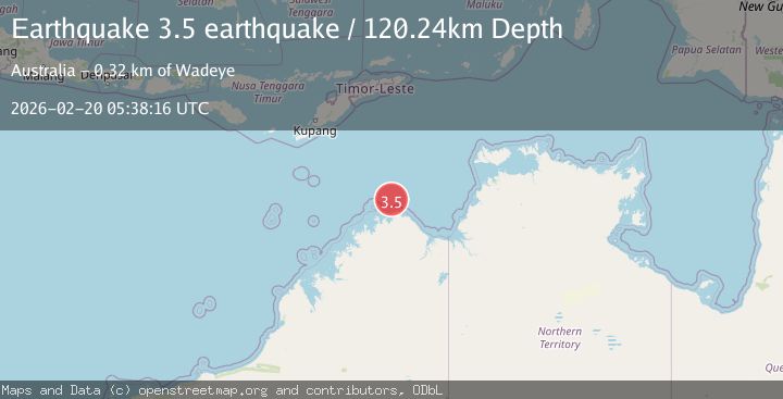
-13.2640, 126.7182
Depth
120.2 KM
Event Summary
A 3.5 magnitude earthquake struck on Western Australia, at Fri, 20 Feb 2026 05:38:16 GMT. Depth: 120.2392578125km. Reviewed by VYT seismologists, this minor quake occurred at a magnitude type of earthquake.
Magnitude
3.5
earthquake
Source
VYT
Intensity
-
Agency Reports
1 Sources| Source | Magnitude | Depth | Time |
|---|---|---|---|
| VYTPrimary | 3.5 | 120 km | 3 months ago |
Earthquake Details
AutomaticEvent IDvyt_n0ivje6k3oej
QualityD
Tsunami PotentialNo
Magnitude Typeearthquake
Last Update3 months ago
Total Stations13
Felt Reports0
Did you feel this earthquake? Report it to help others.
No reports yet
Be the first to report this earthquake!
Latest Earthquakes
Loading...