Earthquake Seram, Indonesia
Mon, 23 Feb 2026 19:37:34 GMT
Time2 hours ago
Location
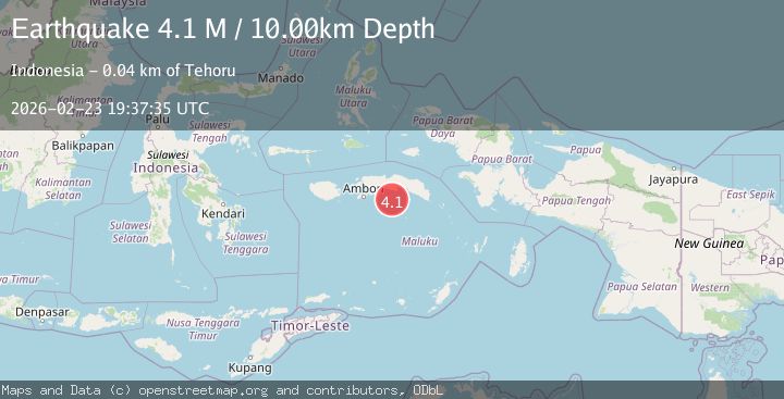
-3.8216, 129.2855
Depth
3.9 KM
Event Summary
A 3.9 magnitude earthquake struck on Seram, Indonesia, at Mon, 23 Feb 2026 19:37:34 GMT. Depth: 3.90625km. Reviewed by VYT seismologists, this minor quake occurred at a magnitude type of earthquake.
Magnitude
3.9
earthquake
Source
VYT
Intensity
-
Agency Reports
1 Sources| Source | Magnitude | Depth | Time |
|---|---|---|---|
| VYTPrimary | 3.9 | 4 km | 2 hours ago |
Earthquake Details
AutomaticEvent IDvyt_x984exxkcpx5
Tsunami PotentialNo
Magnitude Typeearthquake
Nearest Places
- 42.7 km
- 45.8 km
- 46.6 km
- 47.5 km
- 48.9 km
Comments
Join the discussion about this event.
Latest Earthquakes
2.1Mag
Fox Islands, Aleutian Islands, Alaska
Time2 hours ago
Depth51.76 km
SourceVYT (Automatic)
1.2Mag
10 km E of Eielson Air Force Base, Alaska
Time2 hours ago
Depth5.00 km
SourceUSGS (Automatic)
2.1Mag
Fox Islands, Aleutian Islands, Alaska
Time2 hours ago
Depth0.00 km
SourceVYT (Automatic)
3.3Mag
Bosnia and Herzegovina
Time2 hours ago
Depth10.00 km
SourceVYT (Automatic)
0.5Mag
2 km NW of The Geysers, CA
Time2 hours ago
Depth3.16 km
SourceUSGS (Automatic)
Nearby Earthquakes
5.5Mag
SERAM, INDONESIA
Time1 year ago
Depth20.00 km
SourceEMSC (Automatic)
4.0Mag
SERAM, INDONESIA
Time3 months ago
Depth94.00 km
SourceBMKG (Automatic)
2.6Mag
Seram, Indonesia
Time1 month ago
Depth7.00 km
SourceBMKG (Automatic)
3.5Mag
SERAM, INDONESIA
Time1 month ago
Depth120.00 km
SourceBMKG (Automatic)
2.5Mag
SERAM, INDONESIA
Time2 months ago
Depth71.00 km
SourceBMKG (Automatic)