Myokosan
Japan
Last Update2 months ago
Elevation
2454 m
Coordinates
36.8910, 138.1140
Status
Unknown
Level 0
Type
Stratovolcano
About Myokosan
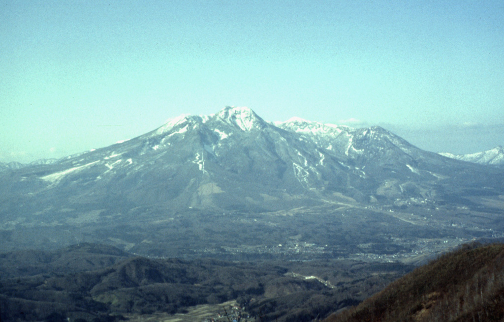
Myokosan is a steep-sided basaltic-to-dacitic stratovolcano north of Nagano City that overlooks Lake Nojiri below its SE flank. A 3-km-wide caldera breached widely to the east is filled by a flat-topped lava dome that forms the summit. It was constructed during four stages beginning about 300,000 years ago, each evolving from basaltic to andesitic and dacitic eruptions. The latest eruptive stage began about 43,000 years ago. Several episodes of edifice collapse during the late Pleistocene to early Holocene have produced major debris avalanches that traveled to the E and NE. Pyroclastic flows traveled down the eastern flanks during the mid-Holocene about 5,800 and 4,200 years ago, and the latest dated eruption produced pyroclastic surges about 2,800-2,500 years ago. Constant solfataric activity occurs between the dome and the south caldera wall at a place where sulfur was once mined.
Volcano Status Guide
5
Danger
4
Eruption
3
Minor
2
Unrest
1
Normal