Katmai
United States
Last Update5 months ago
Elevation
2047 m
Coordinates
58.2790, -154.9533
Status
Normal
Level 1
Type
Stratovolcano
About Katmai
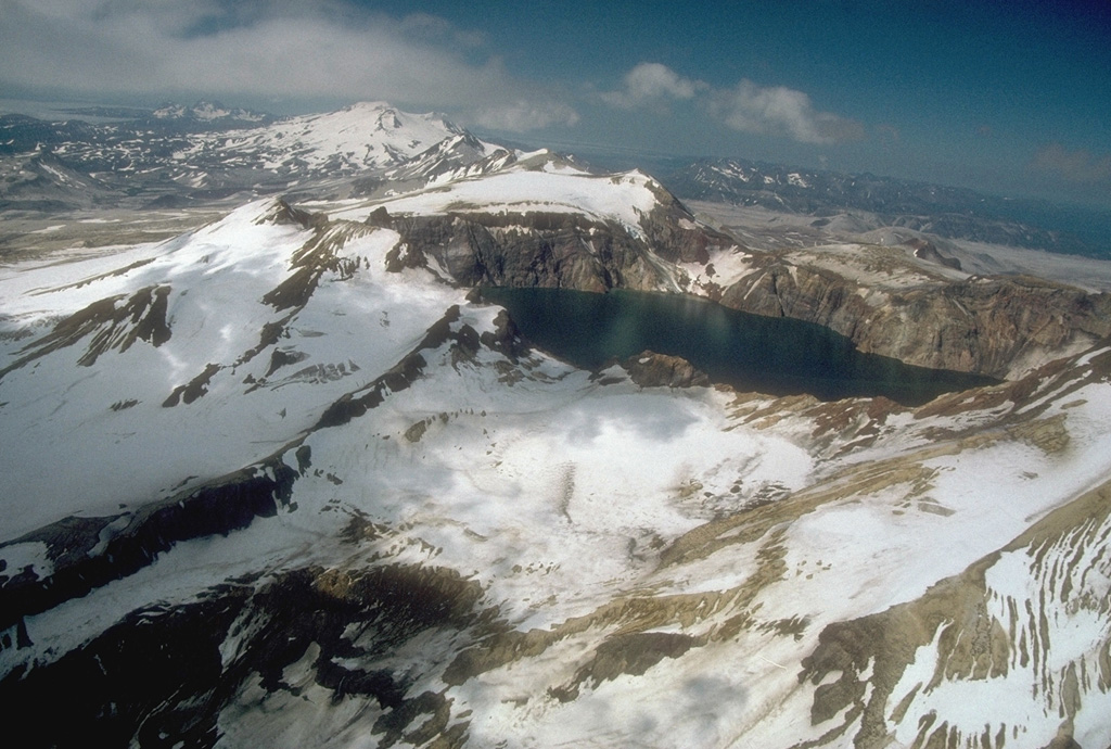
Katmai was initially considered to be the source of the Valley of Ten Thousand Smokes ash flow in 1912. However, the 3 x 4 km caldera of 1912 is now known to have formed as a result of the voluminous eruption at nearby Novarupta volcano. The edifice had four NE-SW-trending summits, most of which were truncated by the 1912 collapse. Two or more large explosive eruptions took place during the late Pleistocene. Most of the two overlapping pre-1912 Katmai volcanoes are Pleistocene, but Holocene lava flows from a flank vent descend the SE flank of the SW edifice into the Katmai River canyon. The steep walled young caldera has a jagged rim that rises 500-1,000 m above the caldera floor and contains a deep lake. Lake waters have covered a small post-collapse lava dome (Horseshoe Island) that was seen on the caldera floor at the time of the initial ascent to the caldera rim in 1916.
Volcano Status Guide
5
Danger
4
Eruption
3
Minor
2
Unrest
1
Normal