Santa Maria del Oro
Mexico
Last Update5 months ago
Elevation
1120 m
Coordinates
21.3710, -104.5710
Status
Unknown
Level 0
Type
Maar
About Santa Maria del Oro
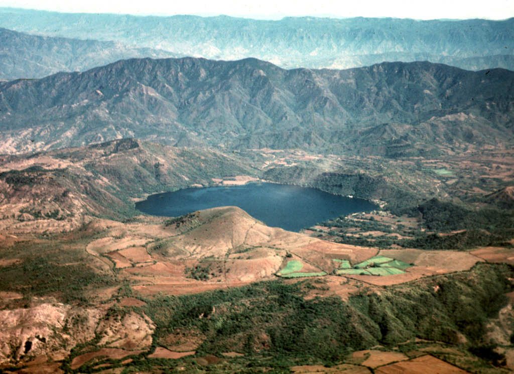
The scenic lake-filled Santa María del Oro maar lies between Sangangüey and Ceboruco volcanoes in the Tepic-Chapala graben. The topographically indistinct outer flanks of the maar give little hint to the dramatic 400 m drop into the Laguna Santa María crater lake. The roughly 3-km-wide maar was erupted through older Miocene rhyolitic ashflow tuffs of the Sierra Madre Occidental. Little is known of the geology or age of Santa María del Oro, but it occurs near the alignment of cinder cones extending from Sangangüey and may have a similar Pleistocene age. Pyroclastic-surge deposits from Santa María del Oro occur in valleys to the north and in some cases along the walls of the crater.
Volcano Status Guide
5
Danger
4
Eruption
3
Minor
2
Unrest
1
Normal