Imbabura
Ecuador
Last Update1 year ago
Elevation
4609 m
Coordinates
0.2580, -78.1830
Status
Normal
Level 1
Type
Compound
About Imbabura
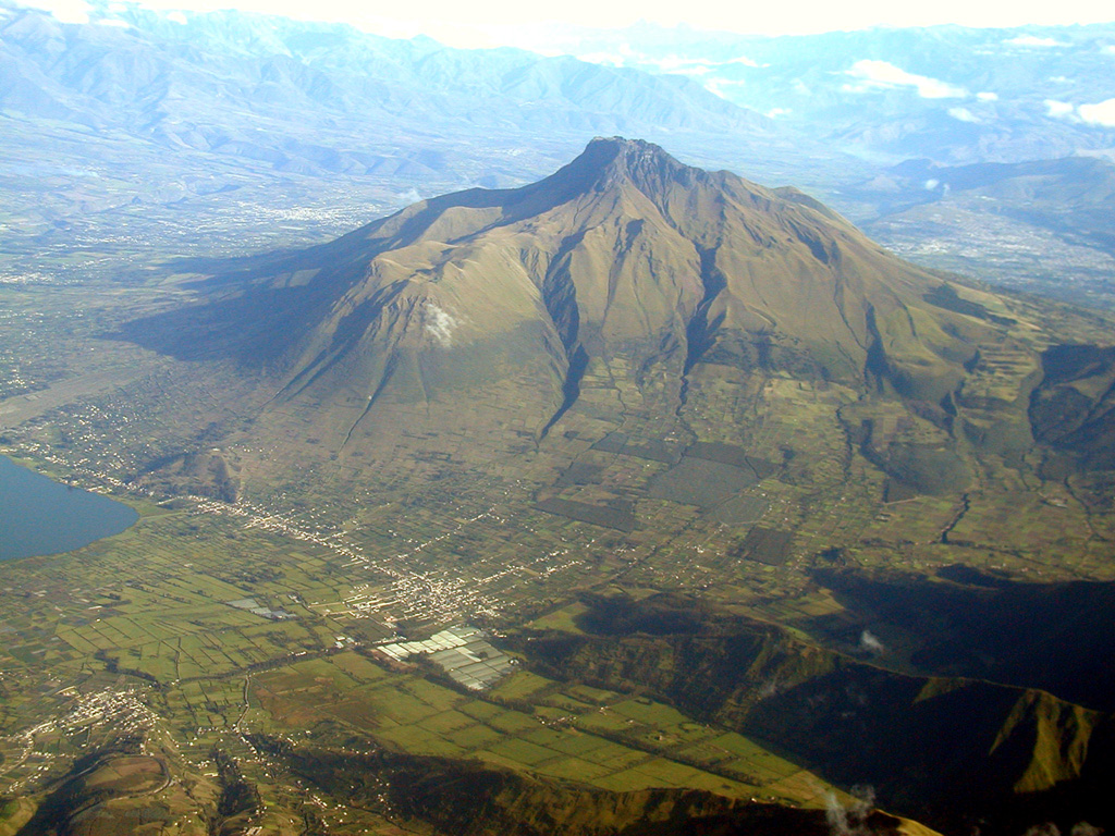
Imbabura volcano rises to the north above scenic Laguna de San Pablo in the Interandean valley about 60 km N of Quito. The main edifice, Taita Imbabura ("Father Imbabura") forms the summit, with Huarmi Imbabura ("Imbabura's Son") forming a lateral lava-dome complex on the SW flank. Activity at the Pleistocene Imbabura I edifice constructed a large andesitic stratovolcano and ended prior to about 43,000 years ago with a major collapse that produced a debris avalanche that traveled 16 km N. Subsequent growth of the Imbabura II stratovolcano continued at least into the early Holocene and typically consisted of growth and collapse of large-volume dacitic lava domes. A major eruption about 25,000 years ago produced a debris avalanche and possible lateral blast and was followed by growth of the Huarmi Imbabura lava dome. Historical reports of eruptions consisted of only mudflows and rock slides.
Volcano Status Guide
5
Danger
4
Eruption
3
Minor
2
Unrest
1
Normal