Pululahua
Ecuador
Last Update1 year ago
Elevation
3360 m
Coordinates
0.0464, -78.4900
Status
Normal
Level 1
Type
Caldera
About Pululahua
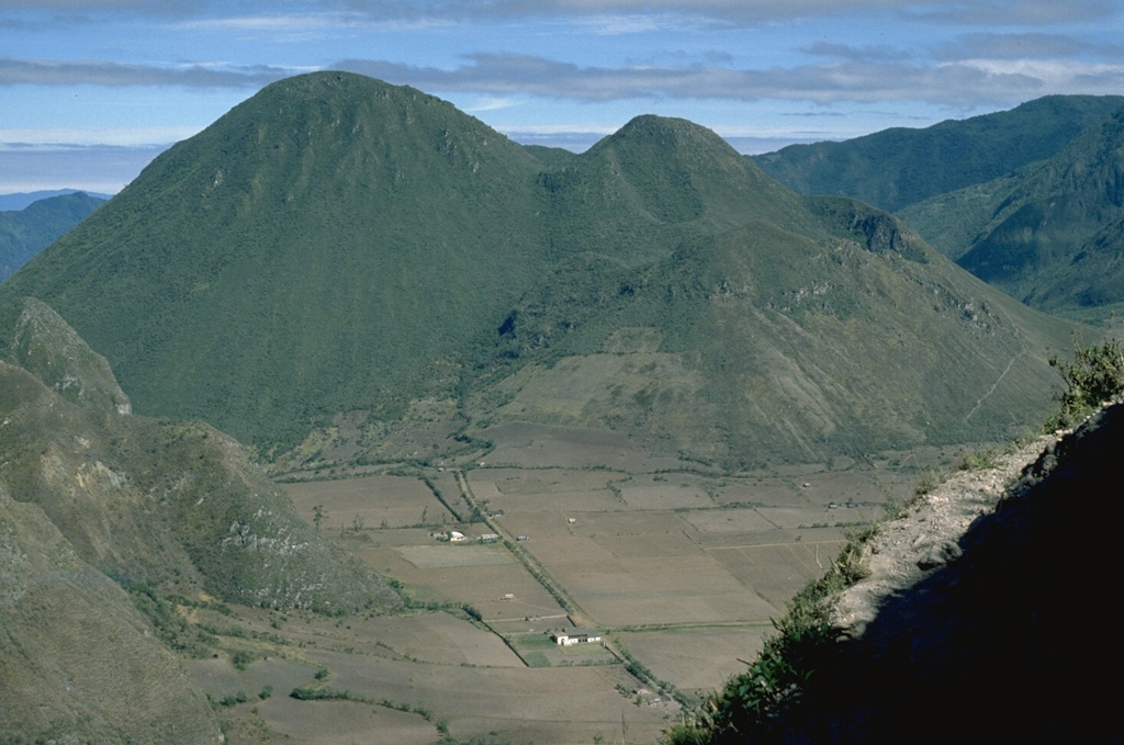
Pululahua is a relatively low, forested volcano about 15 km N of Quito. The 5-km-wide summit caldera is narrowly breached to the west and partially filled by a group of dacitic lava domes. Pre-caldera lava domes of different ages are found outside the caldera to the E, SE, and S. Four post-caldera domes rise up to 450 m above the caldera floor. Large explosive eruptions producing pyroclastic flows took place during the late Pleistocene and Holocene. Caldera formation took place during a series of eruptions lasting 150-200 years beginning about 2,650 radiocarbon years ago. The latest dated eruption occurred from the post-caldera lava domes about 1,670 years ago and produced lava flows and pyroclastic flows.
Volcano Status Guide
5
Danger
4
Eruption
3
Minor
2
Unrest
1
Normal