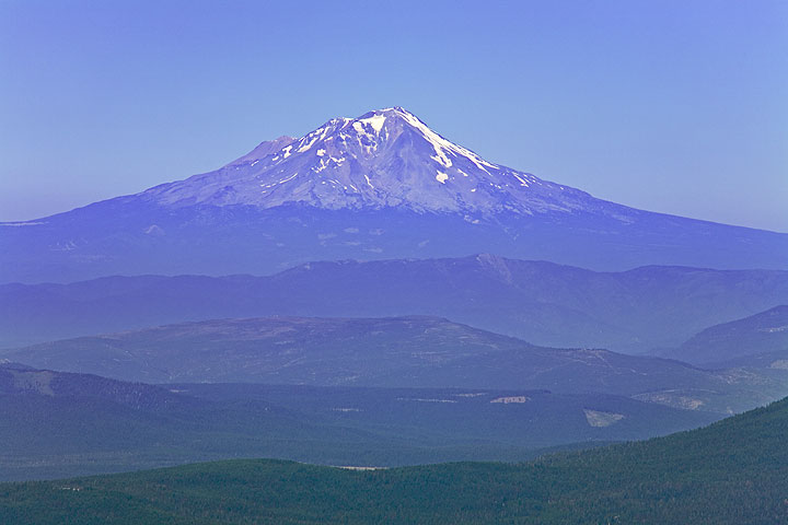
Mount Shasta
California (Canada and USA (mainland))
Last Update56 years ago
Elevation
4322 m
Coordinates
41.4090, -122.1948
Status
Normal
Level 1
Type
stratovolcano
About Mount Shasta
Mt Shasta in Siskiyou County, northen Californian, is the second largest volcano of the Cascade Range. Mount Shasta rises majestically nearly 10,000 ft (3000 m) above the surrounding terrain as it is not connected to any nearby mountain. It has an estimated volume of 350 km3 which makes it the most voluminous stratovolcano in the Cascade Volcanic Arc.
The impressive and beautiful mountain has attracted the attention of poets, authors, ufo-watchers, and is considered a spiritual power center by many.
Geologically, Shasta is remarkable for a giant landslide that removed the entire northern side of the volcano between about 300,000 to 360,000 years ago. With an estimated volume of 6.5 cubic km, it is one of the largest avalanches known on earth. The slide flowed northwestward into Shasta Valley where the Shasta River now cuts through the 28 miles (45 km) long debris flow deposit.
The last confirmed eruption of Mt Shasta happened in 1786 and was observed by the exporer La Pérouse from his ship.
Volcano Status Guide
5
Danger
4
Eruption
3
Minor
2
Unrest
1
Normal