Volcanic Ash Advisory
Dukono
Mon, 07 Sep 2026 19:00:00 GMT
Raw Output
FVAU01 at 18:54 UTC, 07/09/26 from ADRM
VA ADVISORY
DTG: 20260907/1900Z
VAAC: DARWIN
VOLCANO: DUKONO 268010
PSN: N0142 E12754
AREA: INDONESIA
SOURCE ELEV: 1229M AMSL
ADVISORY NR: 2026/723
INFO SOURCE: HIMAWARI-9
ERUPTION DETAILS: VA TO FL070 LAST OBS AT 07/1700Z MOV N
EST VA DTG: 07/1840Z
EST VA CLD: SFC/FL070 N0138 E12800 - N0138 E12746 - N0220
        E12740 - N0220 E12806 - N0208 E12821 MOV N 05KT
FCST VA CLD +6 HR: 08/0040Z SFC/FL070 N0135 E12752 - N0141
        E12745 - N0216 E12758 - N0210 E12818 - N0151 E12826
FCST VA CLD +12 HR: 08/0640Z SFC/FL070 N0135 E12752 - N0141
        E12745 - N0217 E12755 - N0209 E12820 - N0144 E12825
FCST VA CLD +18 HR: 08/1240Z SFC/FL070 N0135 E12752 - N0141
        E12745 - N0216 E12759 - N0204 E12823 - N0140 E12825
RMK: VA NOT IDENTIFIABLE ON SATELLITE IMAGERY. AREA OBSC BY
        MET CLD. VA HEIGHT AND MOV BASED ON LAST SATELLITE OBS AND
        MODEL GUIDANCE.
NXT ADVISORY: NO LATER THAN 20260908/0100Z=
Analysis
Detailed Report
**Volcanic Ash Advisory for Dukono Volcano, Indonesia**
**Date & Time**
* Advisory issued: September 7, 2026, at 19:00 UTC (Coordinated Universal Time).
**Event Summary**
* The Dukono volcano in Indonesia has produced a volcanic ash cloud. The advisory states that ash was last observed at 17:00 UTC on September 7.
**Volcanic Ash Height**
* The ash cloud extends from the surface up to Flight Level 070, which is approximately 7,000 feet above sea level.
**Ash Movement & Direction**
* The ash cloud is moving northward.
* Its movement speed is estimated at 5 knots (about 9 km/h or 6 mph).
**Forecast Ash Dispersion**
The forecast shows the ash cloud continuing to drift generally northward over the next 18 hours:
* **+6 Hours (September 8, 00:40 UTC):** Ash cloud remains at the same height, moving north.
* **+12 Hours (September 8, 06:40 UTC):** Ash cloud at the same height, with a forecasted position north of the volcano.
* **+18 Hours (September 8, 12:40 UTC):** Ash cloud at the same height, forecasted to be further north.
**Important Notes**
* The ash cloud is **not clearly visible on current satellite imagery**.
* The volcano and ash area are obscured by meteorological clouds (weather clouds).
* The reported ash height and movement are based on the last satellite observation and model guidance.
**Next Update Information**
* The next advisory will be issued no later than September 8, 2026, at 01:00 UTC.
Summary
Dukono volcano in Indonesia has ash up to 7,000 feet as of 19:00 UTC on September 7, 2026, moving north.
Dukono
Indonesia
Level 4
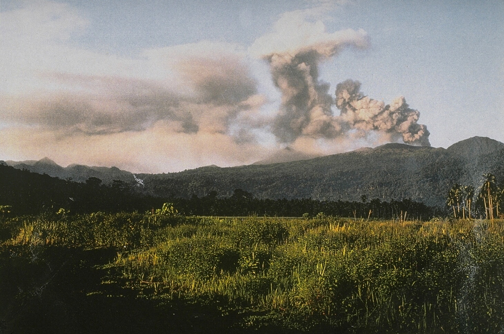
Reports from this remote volcano in northernmost Halmahera are rare, but Dukono has been one of Indonesia's most active volcanoes. More-or-less continuous explosive eruptions, sometimes accompanied by lava flows, have occurred since 1933. During a major eruption in 1550 CE, a lava flow filled in the strait between Halmahera and the N-flank Gunung Mamuya cone. This complex volcano presents a broad, low profile with multiple summit peaks and overlapping craters. Malupang Wariang, 1 km SW of the summit crater complex, contains a 700 x 570 m crater that has also been active during historical time.
View Full Volcano Details