Volcanic Ash Advisory
Ibu
Tue, 08 Sep 2026 01:45:00 GMT
Raw Output
FVAU03 at 01:47 UTC, 08/09/26 from ADRM
VA ADVISORY
DTG: 20260908/0145Z
VAAC: DARWIN
VOLCANO: IBU 268030
PSN: N0129 E12738
AREA: INDONESIA
SOURCE ELEV: 1325M AMSL
ADVISORY NR: 2026/1018
INFO SOURCE: HIMAWARI-9, CVGHM
ERUPTION DETAILS: ERUPTION LAST REPORTED AT 08/0017Z
OBS VA DTG: 08/0120Z
OBS VA CLD: SFC/FL070 N0127 E12739 - N0128 E12736 - N0142
        E12736 - N0143 E12743 - N0138 E12747 MOV N 05KT
FCST VA CLD +6 HR: 08/0720Z SFC/FL070 N0127 E12739 - N0127
        E12736 - N0147 E12733 - N0148 E12746 - N0139 E12753
FCST VA CLD +12 HR: 08/1320Z SFC/FL070 N0127 E12739 - N0128
        E12736 - N0148 E12738 - N0146 E12749 - N0138 E12755
FCST VA CLD +18 HR: 08/1920Z SFC/FL070 N0128 E12738 - N0129
        E12736 - N0148 E12738 - N0146 E12749 - N0138 E12755
RMK: INTERMITTENT DISCRETE ERUPTION IDENTIFIABLE ON
        SATELLITE IMAGERY.  VA HEIGHT AND FCST BASED ON GROUND
        REPORTS AND MODEL GUIDANCE.
NXT ADVISORY: NO LATER THAN 20260908/0745Z=
Analysis
Detailed Report
**Volcanic Ash Advisory: Ibu Volcano, Indonesia**
**Date & Time:**
* Advisory issued: 01:45 UTC on September 8, 2026
* Eruption observed: 00:17 UTC on September 8, 2026
* Ash cloud observed at: 01:20 UTC on September 8, 2026
**Event Summary:**
* The Ibu volcano in Indonesia has erupted.
* The source of the ash is the volcano itself, which has an elevation of 1325 meters.
* The advisory is based on satellite imagery and reports from the Center for Volcanology and Geological Hazard Mitigation (CVGHM) in Indonesia.
**Volcanic Ash Height:**
* The volcanic ash cloud extends from the surface up to Flight Level 070.
* This means the ash reaches up to approximately 7,000 feet (2,133 meters) above mean sea level.
**Ash Movement & Direction:**
* The ash cloud is moving north at a speed of 5 knots (approximately 9.3 kilometers per hour).
**Forecast Ash Dispersion:**
The forecast shows the ash cloud continuing to move northward over the next 18 hours. The cloud is expected to remain at the same height (surface to 7,000 feet).
* **In 6 hours (by 07:20 UTC):** The ash cloud will be located to the north of the volcano.
* **In 12 hours (by 13:20 UTC):** The ash cloud will be located further north.
* **In 18 hours (by 19:20 UTC):** The ash cloud will be in a similar area to the 12-hour forecast.
**Important Notes:**
* The eruption is described as "intermittent and discrete," meaning it is occurring in separate, not continuous, bursts that can be seen on satellite images.
* The information about the ash cloud's height and the forecast is based on ground reports and model guidance.
**Next Update Information:**
The next advisory will be issued no later than 07:45 UTC on September 8, 2026.
Summary
The Ibu volcano in Indonesia erupted at 00:17 UTC on September 8, sending ash up to 2.1 km. Ash is moving north.
Ibu
Indonesia
Level 4
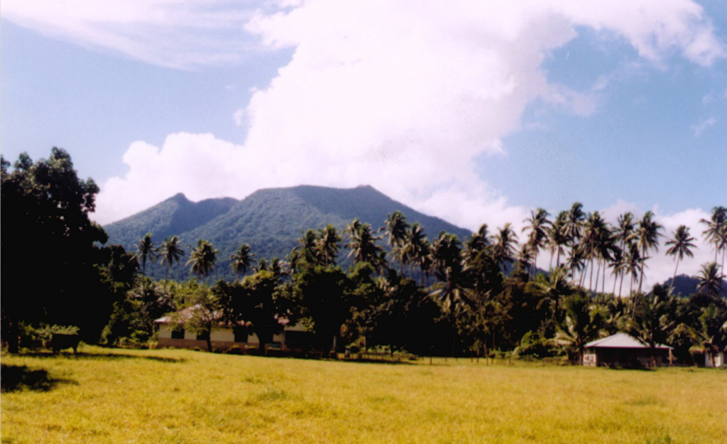
The truncated summit of Gunung Ibu stratovolcano along the NW coast of Halmahera Island has large nested summit craters. The inner crater, 1 km wide and 400 m deep, has contained several small crater lakes. The 1.2-km-wide outer crater is breached on the N, creating a steep-walled valley. A large cone grew ENE of the summit, and a smaller one to the WSW has fed a lava flow down the W flank. A group of maars is located below the N and W flanks. The first observed and recorded eruption was a small explosion from the summit crater in 1911. Eruptive activity began again in December 1998, producing a lava dome that eventually covered much of the floor of the inner summit crater along with ongoing explosive ash emissions.
View Full Volcano Details