Reventador
FVXX22 at 20:11 UTC, 14/07/26 from KNES
VA ADVISORY
DTG: 20260714/2008Z

VAAC: WASHINGTON

VOLCANO: REVENTADOR 352010
PSN: S0005 W07739

AREA: ECUADOR

SOURCE ELEV: 11686 FT AMSL

ADVISORY NR: 2026/690

INFO SOURCE: GOES-19. VONA. NWP MODELS.

ERUPTION DETAILS: VA EM DETECTED

OBS VA DTG: 14/1930Z

OBS VA CLD: SFC/FL140 N0004 W07753 - S0004 W07739
- S0005 W07740 - S0001 W07756 - N0004 W07753 MOV
NW 10KT

FCST VA CLD +6HR: 15/0130Z SFC/FL140 N0007 W07759
- S0004 W07739 - S0005 W07739 - N0001 W07802 -
N0007 W07759

FCST VA CLD +12HR: 15/0730Z SFC/FL140 N0004
W07800 - S0004 W07739 - S0005 W07739 - S0002
W07802 - N0004 W07800

FCST VA CLD +18HR: 15/1330Z NO VA EXP

RMK: VONA RCVD FOR VA EM FM SUMMIT. VA SEEN IN
STLT IMG MOVNG WNW AT APX 15 NMI FM SUMMIT. EXP
CONT WNW MOVEMENT THRU T+12 HRS. FL BSD ON VONA.
FCST BSD ON NWP MDLS.  ...LINER

NXT ADVISORY: WILL BE ISSUED BY 20260715/0215Z
Reventador
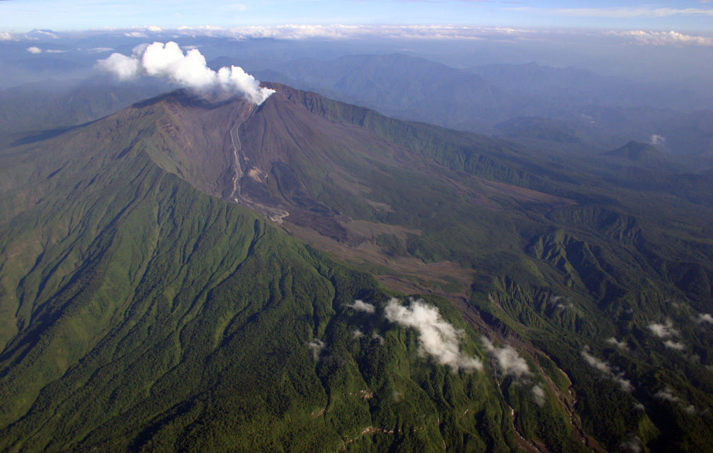
Volcán El Reventador is the most frequently active of a chain of Ecuadorian volcanoes in the Cordillera Real, well east of the principal volcanic axis. The forested, dominantly andesitic stratovolcano has 4-km-wide avalanche scarp open to the E formed by edifice collapse. A young, unvegetated, cone rises from the amphitheater floor to a height comparable to the rim. It has been the source of numerous lava flows as well as explosive eruptions visible from Quito, about 90 km ESE. Frequent lahars in this region of heavy rainfall have left extensive deposits on the scarp slope. The largest recorded eruption took place in 2002, producing a 17-km-high eruption column, pyroclastic flows that traveled up to 8 km, and lava flows from summit and flank vents.
View Full Volcano Details