Earthquake West Papua, Indonesia
Thu, 01 Jan 2026 06:02:00 GMT
Time1 hour ago
Location
-4.2252, 138.4370
Depth
131.3 KM
Event Summary
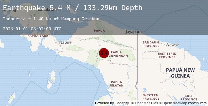
A 4.8 magnitude earthquake struck on West Papua, Indonesia, at Thu, 01 Jan 2026 06:02:00 GMT. Depth: 131.275909km. Reviewed by BMKG seismologists, this light quake occurred at a magnitude type of M.
Magnitude
4.8
M
Source
BMKG
Intensity
-
Earthquake Details
AutomaticEvent IDbmg2026aaly
Tsunami PotentialNo
Magnitude TypeM
Nearest Places
- Kampung Silankuru1.0 km
- Kampung Kaboneri1.0 km
- Kampung Dal2.5 km
- Kampung Yebadolma2.5 km
- Kampung Silan2.7 km
Comments
Join the discussion about this event.
Latest Earthquakes
0.5Mag
6 km ENE of Aguanga, CA
Time2 hours ago
Depth12.44 km
SourceUSGS (Automatic)
0.8Mag
10 km NW of The Geysers, CA
Time2 hours ago
Depth1.77 km
SourceUSGS (Automatic)
2.3Mag
Sulawesi, Indonesia
Time2 hours ago
Depth5.00 km
SourceBMKG (Automatic)
5.0Mag
NEAR EAST COAST OF KAMCHATKA
Time2 hours ago
Depth5.40 km
SourceEMSC (Automatic)
4.9Mag
188 km SSE of Vilyuchinsk, Russia
Time2 hours ago
Depth32.92 km
SourceUSGS
Nearby Earthquakes
No significant earthquakes nearby recently.