Earthquake 10 km NW of The Geysers, CA
Thu, 01 Jan 2026 05:48:22 GMT
Time1 hour ago
Location
38.8280, -122.8530
Depth
1.8 KM
Event Summary
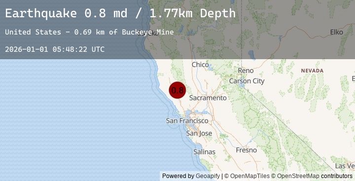
A 0.8 magnitude earthquake struck on 10 km NW of The Geysers, CA, at Thu, 01 Jan 2026 05:48:22 GMT. Depth: 1.76999998092651km. Reviewed by USGS seismologists, this minor quake occurred at a magnitude type of md.
Magnitude
0.8
md
Source
USGS
Intensity
-
Earthquake Details
AutomaticEvent IDusgs_nc75289546
Tsunami PotentialNo
Magnitude Typemd
Nearest Places
- Buckeye Mine0.7 km
- Hummingbird Creek1.3 km
- Alder Creek1.5 km
- Wildhorse Creek1.6 km
- Truitt Creek1.8 km
Comments
Join the discussion about this event.
Latest Earthquakes
1.8Mag
17 km NE of Tres Pinos, CA
Time36 minutes ago
Depth36.94 km
SourceUSGS (Automatic)
1.7Mag
5 km SE of San Ramon, CA
Time46 minutes ago
Depth8.52 km
SourceUSGS (Automatic)
2.6Mag
West Papua Region, Indonesia
Time49 minutes ago
Depth10.00 km
SourceBMKG (Automatic)
2.6Mag
PAPUA, INDONESIA
Time49 minutes ago
Depth10.00 km
SourceEMSC (Automatic)
5.5Mag
91 km NNW of Yakutat, Alaska
Time50 minutes ago
Depth14.00 km
SourceUSGS
Nearby Earthquakes
1.3Mag
2 km WNW of The Geysers, CA
Time51 minutes ago
Depth3.47 km
SourceUSGS (Automatic)
0.8Mag
2 km NNW of The Geysers, CA
Time1 hour ago
Depth1.48 km
SourceUSGS (Automatic)
0.4Mag
9 km NW of The Geysers, CA
Time1 hour ago
Depth2.25 km
SourceUSGS (Automatic)
2.0Mag
2 km N of The Geysers, CA
Time4 hours ago
Depth0.80 km
SourceUSGS (Automatic)
1.1Mag
2 km N of The Geysers, CA
Time4 hours ago
Depth1.45 km
SourceUSGS (Automatic)