Earthquake West Papua, Indonesia
Fri, 02 Jan 2026 01:30:54 GMT
Time1 hour ago
Location
-3.3504, 140.2915
Depth
59.3 KM
Event Summary
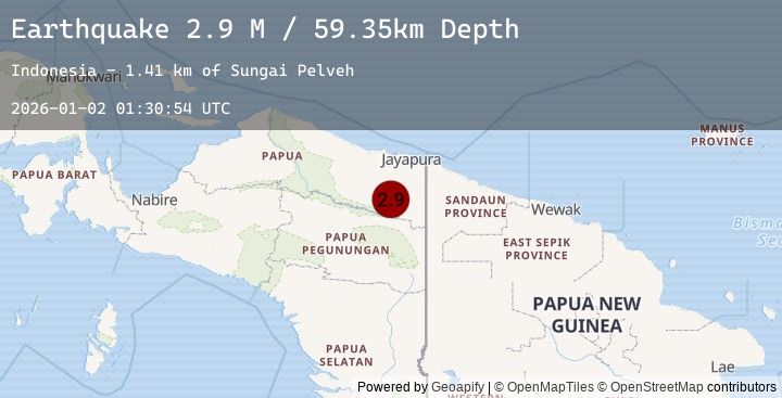
A 2.9 magnitude earthquake struck on West Papua, Indonesia, at Fri, 02 Jan 2026 01:30:54 GMT. Depth: 59.349693km. Reviewed by BMKG seismologists, this minor quake occurred at a magnitude type of M.
Magnitude
2.9
M
Source
BMKG
Intensity
-
Agency Reports
1 Sources| Source | Magnitude | Depth | Time |
|---|---|---|---|
| BMKGPrimary | 2.9 | 59 km | 1 hour ago |
Earthquake Details
AutomaticEvent IDbmg2026abyn
Tsunami PotentialNo
Magnitude TypeM
Nearest Places
- Sungai Pelveh1.4 km
- Songgolo2.3 km
- Kiveh15.9 km
- Kampung Aurina15.9 km
- Pauwasi17.7 km
Comments
Join the discussion about this event.
Latest Earthquakes
3.3Mag
JUJUY, ARGENTINA
Time1 hour ago
Depth162.00 km
SourceNSNA (Automatic)
2.8Mag
ANTOFAGASTA, CHILE
Time2 hours ago
Depth118.60 km
SourceCSN (Automatic)
1.0Mag
7 km NW of The Geysers, CA
Time2 hours ago
Depth1.38 km
SourceUSGS (Automatic)
3.2Mag
SAN FRANCISCO BAY AREA, CALIF.
Time2 hours ago
Depth8.50 km
SourceNC (Automatic)
4.2Mag
OFFSHORE LOS LAGOS, CHILE
Time2 hours ago
Depth42.10 km
SourceCSN (Automatic)