Earthquake West Papua Region, Indonesia
Fri, 02 Jan 2026 04:47:52 GMT
Time3 hours ago
Location
-1.8789, 134.2839
Depth
10.0 KM
Event Summary
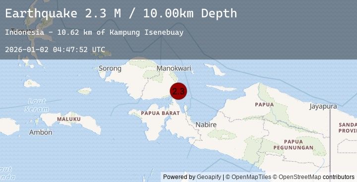
A 2.3 magnitude earthquake struck on West Papua Region, Indonesia, at Fri, 02 Jan 2026 04:47:52 GMT. Depth: 10km. Reviewed by BMKG seismologists, this minor quake occurred at a magnitude type of M.
Magnitude
2.3
M
Source
BMKG
Intensity
-
Agency Reports
1 Sources| Source | Magnitude | Depth | Time |
|---|---|---|---|
| BMKGPrimary | 2.3 | 10 km | 3 hours ago |
Earthquake Details
AutomaticEvent IDbmg2026acez
Tsunami PotentialNo
Magnitude TypeM
Nearest Places
- Kampung Isenebuay10.6 km
- Senebuai11.4 km
- Distrik Rumberpon12.1 km
- Pulau Rumberpon12.8 km
- Jalia13.0 km
Comments
Join the discussion about this event.
Latest Earthquakes
1.3Mag
24 km SSW of Frazier Park, CA
Time3 hours ago
Depth-0.02 km
SourceUSGS (Automatic)
3.5Mag
GUADELOUPE REGION, LEEWARD ISL.
Time3 hours ago
Depth10.00 km
SourceTRN (Automatic)
1.9Mag
93 km WNW of Yakutat, Alaska
Time3 hours ago
Depth4.70 km
SourceUSGS (Automatic)
3.4Mag
Sulawesi, Indonesia
Time3 hours ago
Depth7.52 km
SourceBMKG (Automatic)
2.7Mag
TARAPACA, CHILE
Time3 hours ago
Depth108.40 km
SourceCSN (Automatic)
Nearby Earthquakes
No significant earthquakes nearby recently.