Earthquake Minahassa Peninsula, Sulawesi
Fri, 02 Jan 2026 17:17:32 GMT
Time2 hours ago
Location
0.2300, 122.0351
Depth
168.1 KM
Event Summary
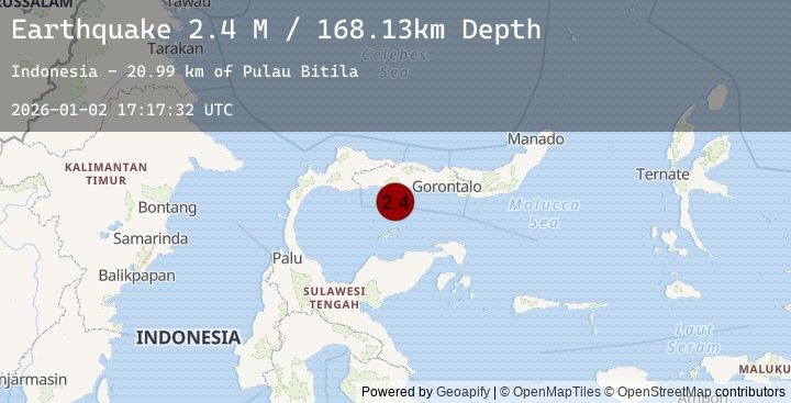
A 2.4 magnitude earthquake struck on Minahassa Peninsula, Sulawesi, at Fri, 02 Jan 2026 17:17:32 GMT. Depth: 168.125336km. Reviewed by BMKG seismologists, this minor quake occurred at a magnitude type of M.
Magnitude
2.4
M
Source
BMKG
Intensity
-
Agency Reports
1 Sources| Source | Magnitude | Depth | Time |
|---|---|---|---|
| BMKGPrimary | 2.4 | 168 km | 2 hours ago |
Earthquake Details
AutomaticEvent IDbmg2026adds
Tsunami PotentialNo
Magnitude TypeM
Nearest Places
- Pulau Bitila21.0 km
- Lito Lolahe22.6 km
- Lito Pomolia Kiki24.8 km
- Lito Pomolia Daa25.0 km
- Lito Puntu25.4 km
Comments
Join the discussion about this event.
Latest Earthquakes
2.2Mag
West Papua Region, Indonesia
Time2 hours ago
Depth10.00 km
SourceBMKG (Automatic)
3.1Mag
ISLAND OF HAWAII, HAWAII
Time2 hours ago
Depth39.20 km
SourceHV (Automatic)
2.3Mag
Near North Coast of West Papua
Time2 hours ago
Depth45.71 km
SourceBMKG (Automatic)
4.3Mag
Mindanao, Philippines
Time2 hours ago
Depth10.00 km
SourceBMKG (Automatic)
2.4Mag
WESTERN TURKEY
Time3 hours ago
Depth8.20 km
SourceEMSC (Automatic)
Nearby Earthquakes
2.6Mag
Minahassa Peninsula, Sulawesi
Time3 hours ago
Depth110.71 km
SourceBMKG (Automatic)
2.1Mag
Minahassa Peninsula, Sulawesi
Time5 hours ago
Depth74.36 km
SourceBMKG (Automatic)
2.3Mag
Minahassa Peninsula, Sulawesi
Time6 hours ago
Depth1.60 km
SourceBMKG (Automatic)
2.3Mag
Minahassa Peninsula, Sulawesi
Time1 day ago
Depth33.06 km
SourceBMKG (Automatic)
2.1Mag
Minahassa Peninsula, Sulawesi
Time1 day ago
Depth36.47 km
SourceBMKG (Automatic)