Earthquake Southern Sumatra, Indonesia
Sat, 03 Jan 2026 20:00:36 GMT
Time4 days ago
Location
-3.2995, 105.5300
Depth
16.8 KM
Event Summary
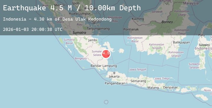
A 4.4 magnitude earthquake struck on Southern Sumatra, Indonesia, at Sat, 03 Jan 2026 20:00:36 GMT. Depth: 16.763033km. Reviewed by BMKG seismologists, this light quake occurred at a magnitude type of M.
Magnitude
4.4
M
Source
BMKG
Intensity
-
Agency Reports
1 Sources| Source | Magnitude | Depth | Time |
|---|---|---|---|
| BMKGPrimary | 4.4 | 17 km | 4 days ago |
Earthquake Details
AutomaticEvent IDbmg2026afep
Tsunami PotentialNo
Magnitude TypeM
Nearest Places
- Desa Simpang Tiga8.7 km
- Sungai Talangrimbo9.1 km
- Simpangtiga9.7 km
- Sungai Riamun13.1 km
- Desa Ulak Kedondong13.6 km
Comments
Join the discussion about this event.
Latest Earthquakes
1.5Mag
17 km SE of Stanton, Texas
Time4 days ago
Depth3.55 km
SourceUSGS (Automatic)
4.4Mag
TAIWAN
Time4 days ago
Depth8.70 km
SourceCWB (Automatic)
2.7Mag
West Papua Region, Indonesia
Time4 days ago
Depth10.00 km
SourceBMKG (Automatic)
2.0Mag
HAWAII REGION, HAWAII
Time4 days ago
Depth9.10 km
SourceHV (Automatic)
1.4Mag
8 km ESE of Valle Vista, CA
Time4 days ago
Depth16.59 km
SourceUSGS (Automatic)
Nearby Earthquakes
No significant earthquakes nearby recently.