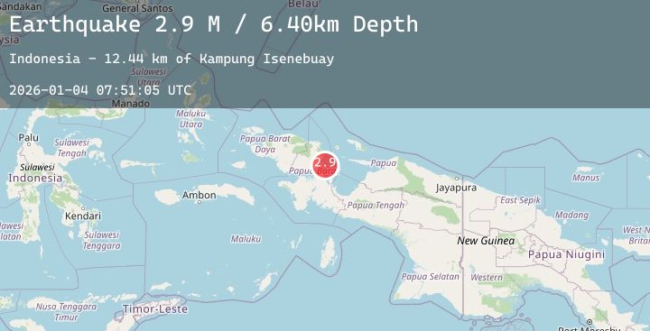
Earthquake West Papua Region, Indonesia
Sun, 04 Jan 2026 07:51:05 GMT
Time4 days ago
Location
-1.8905, 134.2981
Depth
10.0 KM
Event Summary
A 2.8 magnitude earthquake struck on West Papua Region, Indonesia, at Sun, 04 Jan 2026 07:51:05 GMT. Depth: 10km. Reviewed by BMKG seismologists, this minor quake occurred at a magnitude type of M.
Magnitude
2.8
M
Source
BMKG
Intensity
-
Agency Reports
1 Sources| Source | Magnitude | Depth | Time |
|---|---|---|---|
| BMKGPrimary | 2.8 | 10 km | 4 days ago |
Earthquake Details
AutomaticEvent IDbmg2026agcb
Tsunami PotentialNo
Magnitude TypeM
Nearest Places
- Kampung Isenebuay12.4 km
- Senebuai12.8 km
- Distrik Rumberpon14.0 km
- Pulau Rumberpon14.8 km
- Jalia14.9 km
Comments
Join the discussion about this event.
Latest Earthquakes
2.7Mag
Java, Indonesia
Time4 days ago
Depth49.33 km
SourceBMKG (Automatic)
1.7Mag
21 km NNW of Tehachapi, CA
Time4 days ago
Depth5.43 km
SourceUSGS (Automatic)
1.7Mag
14 km WSW of Round Valley, CA
Time4 days ago
Depth6.39 km
SourceUSGS (Automatic)
2.2Mag
WESTERN TURKEY
Time4 days ago
Depth7.00 km
SourceAFAD (Automatic)
3.1Mag
TARAPACA, CHILE
Time4 days ago
Depth104.70 km
SourceCSN (Automatic)
Nearby Earthquakes
No significant earthquakes nearby recently.