Earthquake South of Bali, Indonesia
Mon, 05 Jan 2026 20:07:34 GMT
Time2 days ago
Location
-9.3967, 115.6683
Depth
25.5 KM
Event Summary
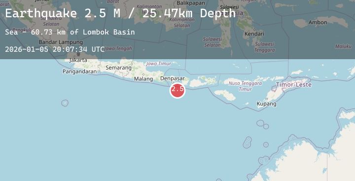
A 2.4 magnitude earthquake struck on South of Bali, Indonesia, at Mon, 05 Jan 2026 20:07:34 GMT. Depth: 25.466454km. Reviewed by BMKG seismologists, this minor quake occurred at a magnitude type of M.
Magnitude
2.4
M
Source
BMKG
Intensity
-
Agency Reports
1 Sources| Source | Magnitude | Depth | Time |
|---|---|---|---|
| BMKGPrimary | 2.4 | 25 km | 2 days ago |
Earthquake Details
AutomaticEvent IDbmg2026aivw
Tsunami PotentialNo
Magnitude TypeM
Nearest Places
- Lombok Basin60.7 km
- Pulau Sophialouisa64.1 km
- Tanjung Bakung64.8 km
- Teluk Sedihing65.0 km
- Tukad Tumpanggintungan65.1 km
Comments
Join the discussion about this event.
Latest Earthquakes
2.0Mag
SICILY, ITALY
Time2 days ago
Depth19.30 km
SourceINGV (Automatic)
2.1Mag
Southern Sumatra, Indonesia
Time2 days ago
Depth2.75 km
SourceBMKG (Automatic)
1.8Mag
5 km N of Dublin, CA
Time2 days ago
Depth7.63 km
SourceUSGS (Automatic)
2.0Mag
68 km ESE of Cantwell, Alaska
Time3 days ago
Depth6.30 km
SourceUSGS (Automatic)
0.7Mag
8 km SW of Idyllwild, CA
Time3 days ago
Depth14.29 km
SourceUSGS (Automatic)
Nearby Earthquakes
No significant earthquakes nearby recently.