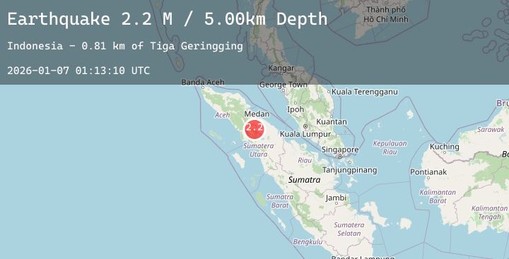
Earthquake Northern Sumatra, Indonesia
Wed, 07 Jan 2026 01:13:09 GMT
Time1 day ago
Location
3.0366, 98.5569
Depth
2.6 KM
Event Summary
A 2.2 magnitude earthquake struck on Northern Sumatra, Indonesia, at Wed, 07 Jan 2026 01:13:09 GMT. Depth: 2.601783km. Reviewed by BMKG seismologists, this minor quake occurred at a magnitude type of M.
Magnitude
2.2
M
Source
BMKG
Intensity
-
Agency Reports
1 Sources| Source | Magnitude | Depth | Time |
|---|---|---|---|
| BMKGPrimary | 2.2 | 3 km | 1 day ago |
Earthquake Details
AutomaticEvent IDbmg2026albl
Tsunami PotentialNo
Magnitude TypeM
Nearest Places
- Desa Rumamis0.2 km
- Rumanis Dua0.9 km
- Rumanis Satu0.9 km
- Semangat1.5 km
- Desa Semangat1.6 km
Comments
Join the discussion about this event.
Latest Earthquakes
1.3Mag
11 km ENE of Fox, Alaska
Time1 day ago
Depth3.40 km
SourceUSGS (Automatic)
2.8Mag
OFFSHORE EL SALVADOR
Time1 day ago
Depth26.00 km
SourceINET (Automatic)
2.7Mag
Near North Coast of West Papua
Time1 day ago
Depth35.22 km
SourceBMKG (Automatic)
3.8Mag
SALTA, ARGENTINA
Time1 day ago
Depth228.40 km
SourceCSN (Automatic)
1.2Mag
EASTERN TURKEY
Time1 day ago
Depth6.90 km
SourceAFAD (Automatic)