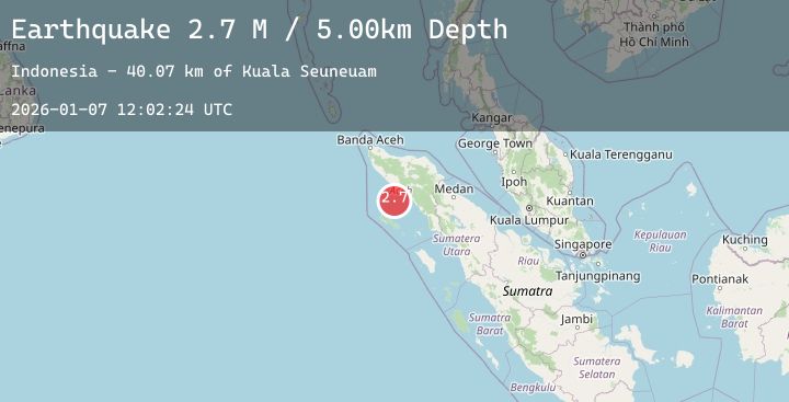
Earthquake Northern Sumatra, Indonesia
Wed, 07 Jan 2026 12:02:24 GMT
Time1 day ago
Location
3.4294, 96.3596
Depth
8.8 KM
Event Summary
A 2.9 magnitude earthquake struck on Northern Sumatra, Indonesia, at Wed, 07 Jan 2026 12:02:24 GMT. Depth: 8.801156km. Reviewed by BMKG seismologists, this minor quake occurred at a magnitude type of M.
Magnitude
2.9
M
Source
BMKG
Intensity
-
Agency Reports
1 Sources| Source | Magnitude | Depth | Time |
|---|---|---|---|
| BMKGPrimary | 2.9 | 9 km | 1 day ago |
Earthquake Details
AutomaticEvent IDbmg2026alww
Tsunami PotentialNo
Magnitude TypeM
Nearest Places
- Kuala Seuneuam38.1 km
- Ujung Raya39.0 km
- Krueng Seuneuam39.6 km
- Lhokrheue40.3 km
- Kuala Lhoreue40.9 km
Comments
Join the discussion about this event.
Latest Earthquakes
3.2Mag
Northern Sumatra, Indonesia
Time1 day ago
Depth30.63 km
SourceBMKG (Automatic)
1.4Mag
24 km NW of New Idria, CA
Time1 day ago
Depth0.60 km
SourceUSGS (Automatic)
3.8Mag
HOKKAIDO, JAPAN REGION
Time1 day ago
Depth60.00 km
SourceJMA (Automatic)
2.5Mag
Java, Indonesia
Time1 day ago
Depth27.22 km
SourceBMKG (Automatic)
1.0Mag
9 km NE of Julian, CA
Time1 day ago
Depth5.77 km
SourceUSGS (Automatic)