Earthquake Northern Sumatra, Indonesia
Thu, 08 Jan 2026 07:15:25 GMT
Time2 days ago
Location
4.5765, 96.7077
Depth
4.1 KM
Event Summary
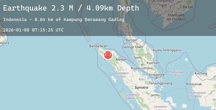
A 2.3 magnitude earthquake struck on Northern Sumatra, Indonesia, at Thu, 08 Jan 2026 07:15:25 GMT. Depth: 4.088559km. Reviewed by BMKG seismologists, this minor quake occurred at a magnitude type of M.
Magnitude
2.3
M
Source
BMKG
Intensity
-
Agency Reports
1 Sources| Source | Magnitude | Depth | Time |
|---|---|---|---|
| BMKGPrimary | 2.3 | 4 km | 2 days ago |
Earthquake Details
AutomaticEvent IDbmg2026anix
Tsunami PotentialNo
Magnitude TypeM
Nearest Places
- Kampung Sepakat0.8 km
- Kampung Ramung Ara1.6 km
- Kampung Kuyun Toa1.7 km
- Kampung Uning Berawang Ramung1.7 km
- Kampung Berawang Gading2.0 km
Comments
Join the discussion about this event.
Latest Earthquakes
2.7Mag
31 km NNW of Valdez, Alaska
Time1 day ago
Depth16.20 km
SourceUSGS (Automatic)
2.7Mag
DODECANESE IS.-TURKEY BORDER REG
Time1 day ago
Depth7.20 km
SourceKOERI (Automatic)
2.6Mag
ANTOFAGASTA, CHILE
Time1 day ago
Depth243.00 km
SourceCSN (Automatic)
4.2Mag
12 km E of Cloverdale, California
Time1 day ago
Depth9.00 km
SourceUSGS (Automatic)
2.1Mag
37 km WSW of Nanwalek, Alaska
Time1 day ago
Depth64.50 km
SourceUSGS (Automatic)