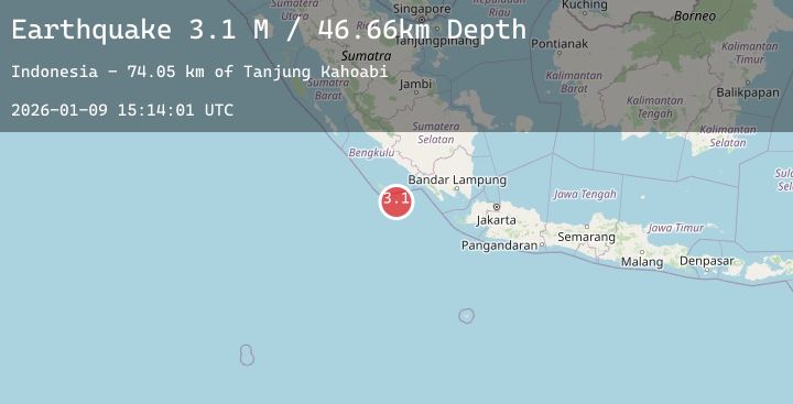
Earthquake Southern Sumatra, Indonesia
Fri, 09 Jan 2026 15:14:01 GMT
Time1 day ago
Location
-5.9834, 102.8312
Depth
46.7 KM
Event Summary
A 3.1 magnitude earthquake struck on Southern Sumatra, Indonesia, at Fri, 09 Jan 2026 15:14:01 GMT. Depth: 46.661736km. Reviewed by BMKG seismologists, this minor quake occurred at a magnitude type of M.
Magnitude
3.1
M
Source
BMKG
Intensity
-
Agency Reports
1 Sources| Source | Magnitude | Depth | Time |
|---|---|---|---|
| BMKGPrimary | 3.1 | 47 km | 1 day ago |
Earthquake Details
AutomaticEvent IDbmg2026apue
Tsunami PotentialNo
Magnitude TypeM
Nearest Places
- Tanjung Kahoabi74.0 km
- Pulau Merbau74.4 km
- Pulau Bangkai75.9 km
- Teluk Kiowa75.9 km
- Pulaudua76.1 km
Comments
Join the discussion about this event.
Latest Earthquakes
2.2Mag
Timor Region
Time1 day ago
Depth80.05 km
SourceBMKG (Automatic)
3.3Mag
Southern Sumatra, Indonesia
Time1 day ago
Depth6.73 km
SourceBMKG (Automatic)
3.0Mag
MOLUCCA SEA
Time1 day ago
Depth103.00 km
SourceBMKG (Automatic)
2.7Mag
TARAPACA, CHILE
Time1 day ago
Depth75.10 km
SourceCSN (Automatic)
0.8Mag
12 km ENE of Cloverdale, CA
Time1 day ago
Depth2.25 km
SourceUSGS (Automatic)