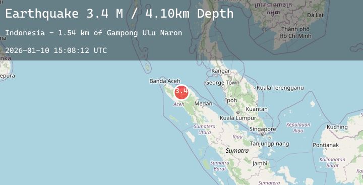
Earthquake Northern Sumatra, Indonesia
Sat, 10 Jan 2026 15:08:12 GMT
Time1 day ago
Location
4.9014, 96.7648
Depth
4.1 KM
Event Summary
A 3.4 magnitude earthquake struck on Northern Sumatra, Indonesia, at Sat, 10 Jan 2026 15:08:12 GMT. Depth: 4.097741km. Reviewed by BMKG seismologists, this minor quake occurred at a magnitude type of M.
Magnitude
3.4
M
Source
BMKG
Intensity
-
Agency Reports
2 Sources| Source | Magnitude | Depth | Time |
|---|---|---|---|
| BMKGPrimary | 3.4 | 5 km | 1 day ago |
| BMKGPrimary | 3.4 | 5 km | 1 day ago |
Earthquake Details
AutomaticEvent IDbmg2026arpm
Tsunami PotentialNo
Magnitude TypeM
Nearest Places
- Gampong Perdamaian1.8 km
- Gampong Ulu Naron2.0 km
- Gampong Taman Firdaus2.1 km
- Gampong Bintang Berangun2.3 km
- Kecamatan Pintu Rime Gayo2.6 km
Comments
Join the discussion about this event.
Latest Earthquakes
1.2Mag
26 km SSW of Ocotillo Wells, CA
Time1 day ago
Depth8.79 km
SourceUSGS (Automatic)
6.8Mag
Talaud Islands, Indonesia
Time1 day ago
Depth20.89 km
SourceBMKG (Automatic)
2.0Mag
Bali Region, Indonesia
Time1 day ago
Depth27.69 km
SourceBMKG (Automatic)
1.4Mag
CENTRAL TURKEY
Time1 day ago
Depth7.00 km
SourceAFAD (Automatic)
2.7Mag
Java, Indonesia
Time1 day ago
Depth194.47 km
SourceBMKG (Automatic)
Nearby Earthquakes
No significant earthquakes nearby recently.