Earthquake Southern Molucca Sea
Mon, 12 Jan 2026 11:51:49 GMT
Time14 hours ago
Location
-0.1336, 124.8598
Depth
9.8 KM
Event Summary
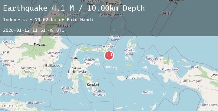
A 4.2 magnitude earthquake struck on Southern Molucca Sea, at Mon, 12 Jan 2026 11:51:49 GMT. Depth: 9.797556km. Reviewed by BMKG seismologists, this light quake occurred at a magnitude type of M.
Magnitude
4.2
M
Source
BMKG
Intensity
-
Agency Reports
1 Sources| Source | Magnitude | Depth | Time |
|---|---|---|---|
| BMKGPrimary | 4.2 | 10 km | 14 hours ago |
Earthquake Details
AutomaticEvent IDbmg2026avaa
Tsunami PotentialNo
Magnitude TypeM
Nearest Places
- Batu Mandi76.7 km
- Pulau Lampu77.3 km
- Tanjung Flesko77.7 km
- Tanjung Palureoi78.5 km
- Tanjung Payunga78.6 km
Comments
Join the discussion about this event.
Latest Earthquakes
2.5Mag
Southern Sumatra, Indonesia
Time14 hours ago
Depth73.23 km
SourceBMKG (Automatic)
2.8Mag
Near North Coast of West Papua
Time14 hours ago
Depth10.00 km
SourceBMKG (Automatic)
0.6Mag
18 km NNW of Borrego Springs, CA
Time14 hours ago
Depth15.11 km
SourceUSGS (Automatic)
2.5Mag
FRANCE
Time14 hours ago
Depth5.00 km
SourceReNaSS (Automatic)
2.6Mag
FRANCE
Time14 hours ago
Depth5.00 km
SourceReNaSS (Automatic)