Earthquake West Papua Region, Indonesia
Tue, 13 Jan 2026 11:17:59 GMT
Time1 day ago
Location
-3.2619, 135.6383
Depth
50.2 KM
Event Summary
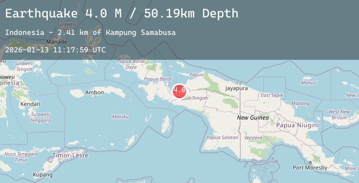
A 3.8 magnitude earthquake struck on West Papua Region, Indonesia, at Tue, 13 Jan 2026 11:17:59 GMT. Depth: 50.186169km. Reviewed by BMKG seismologists, this minor quake occurred at a magnitude type of M.
Magnitude
3.8
M
Source
BMKG
Intensity
-
Agency Reports
1 Sources| Source | Magnitude | Depth | Time |
|---|---|---|---|
| BMKGPrimary | 3.8 | 50 km | 1 day ago |
Earthquake Details
AutomaticEvent IDbmg2026awuk
Tsunami PotentialNo
Magnitude TypeM
Nearest Places
- Kampung Samabusa2.4 km
- Kampung Air Mandidi3.7 km
- Distrik Teluk Kimi4.0 km
- Kampung Kimi7.2 km
- Kimi7.4 km
Comments
Join the discussion about this event.
Latest Earthquakes
2.8Mag
Java, Indonesia
Time1 day ago
Depth17.93 km
SourceBMKG (Automatic)
0.6Mag
9 km NW of The Geysers, CA
Time1 day ago
Depth2.04 km
SourceUSGS (Automatic)
2.1Mag
FRANCE
Time1 day ago
Depth5.00 km
SourceReNaSS (Automatic)
2.4Mag
Sumbawa Region, Indonesia
Time1 day ago
Depth29.86 km
SourceBMKG (Automatic)
1.9Mag
6 km SW of Volcano, Hawaii
Time1 day ago
Depth1.55 km
SourceUSGS (Automatic)