Earthquake Timor Region
Thu, 15 Jan 2026 08:21:26 GMT
Time9 hours ago
Location
-10.1821, 123.4086
Depth
29.0 KM
Event Summary
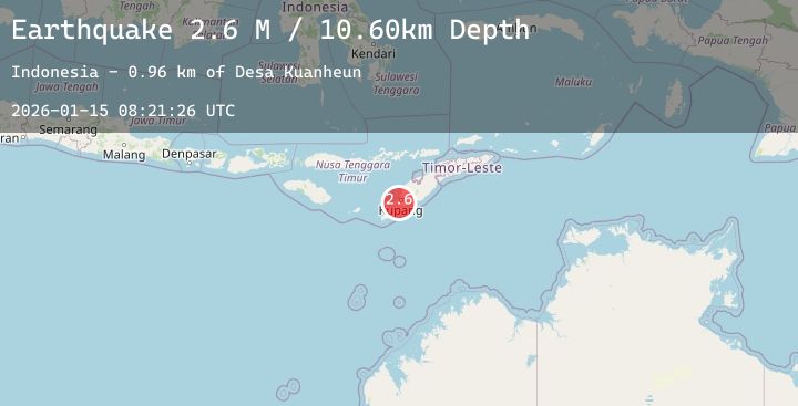
A 3.0 magnitude earthquake struck on Timor Region, at Thu, 15 Jan 2026 08:21:26 GMT. Depth: 29.001444km. Reviewed by BMKG seismologists, this minor quake occurred at a magnitude type of M.
Magnitude
3.0
M
Source
BMKG
Intensity
-
Agency Reports
2 Sources| Source | Magnitude | Depth | Time |
|---|---|---|---|
| BMKGPrimary | 3.0 | 29 km | 9 hours ago |
| BMKGPrimary | 2.6 | 11 km | 9 hours ago |
Earthquake Details
AutomaticEvent IDbmg2026bafp
Tsunami PotentialNo
Magnitude TypeM
Nearest Places
- Bolantami0.7 km
- Cekdam Bolantami0.7 km
- Desa Uitao0.9 km
- Uitao1.0 km
- Palun Tuan1.0 km
Comments
Join the discussion about this event.
Latest Earthquakes
2.4Mag
26 km WSW of Point MacKenzie, Alaska
Time9 hours ago
Depth37.00 km
SourceUSGS (Automatic)
2.9Mag
JUJUY, ARGENTINA
Time9 hours ago
Depth275.00 km
SourceNSNA (Automatic)
1.4Mag
9 km NW of The Geysers, CA
Time9 hours ago
Depth1.62 km
SourceUSGS (Automatic)
1.0Mag
WESTERN TURKEY
Time9 hours ago
Depth7.70 km
SourceAFAD (Automatic)
1.3Mag
NEAR THE COAST OF WESTERN TURKEY
Time10 hours ago
Depth7.10 km
SourceAFAD (Automatic)
Nearby Earthquakes
No significant earthquakes nearby recently.