Earthquake Bali Sea
Thu, 15 Jan 2026 16:42:28 GMT
Time3 hours ago
Location
-7.6169, 117.4973
Depth
13.8 KM
Event Summary
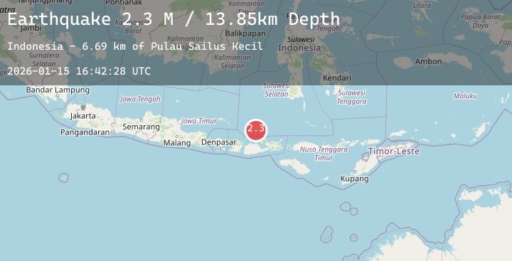
A 2.3 magnitude earthquake struck on Bali Sea, at Thu, 15 Jan 2026 16:42:28 GMT. Depth: 13.846702km. Reviewed by BMKG seismologists, this minor quake occurred at a magnitude type of M.
Magnitude
2.3
M
Source
BMKG
Intensity
-
Agency Reports
1 Sources| Source | Magnitude | Depth | Time |
|---|---|---|---|
| BMKGPrimary | 2.3 | 14 km | 3 hours ago |
Earthquake Details
AutomaticEvent IDbmg2026bawc
Tsunami PotentialNo
Magnitude TypeM
Nearest Places
- Pulau Sailus Kecil6.7 km
- Desa Poleonro6.7 km
- Desa Sailus12.5 km
- Pulau Sailus Besar12.5 km
- Kepulauan Tengah13.0 km
Comments
Join the discussion about this event.
Latest Earthquakes
2.3Mag
Sumbawa Region, Indonesia
Time3 hours ago
Depth84.33 km
SourceBMKG (Automatic)
4.1Mag
ANTOFAGASTA, CHILE
Time3 hours ago
Depth75.00 km
SourceCSN (Automatic)
1.4Mag
21 km NE of San Ardo, CA
Time3 hours ago
Depth8.05 km
SourceUSGS (Automatic)
2.7Mag
NEAR COAST OF NICARAGUA
Time3 hours ago
Depth30.00 km
SourceINET (Automatic)
4.1Mag
Flores Region, Indonesia
Time3 hours ago
Depth194.99 km
SourceBMKG (Automatic)
Nearby Earthquakes
2.1Mag
Sumbawa Region, Indonesia
Time6 hours ago
Depth2.25 km
SourceBMKG (Automatic)
3.4Mag
Bali Sea
Time8 hours ago
Depth16.75 km
SourceBMKG (Automatic)
2.2Mag
Sumbawa Region, Indonesia
Time16 hours ago
Depth10.82 km
SourceBMKG (Automatic)
2.0Mag
Sumbawa Region, Indonesia
Time19 hours ago
Depth21.43 km
SourceBMKG (Automatic)
2.1Mag
Sumbawa Region, Indonesia
Time1 day ago
Depth10.00 km
SourceBMKG (Automatic)