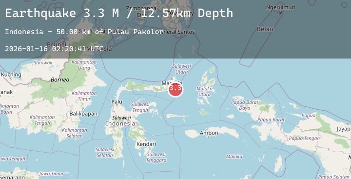
Earthquake Northern Molucca Sea
Fri, 16 Jan 2026 02:20:39 GMT
Time1 hour ago
Location
0.4934, 125.2105
Depth
9.7 KM
Event Summary
A 3.4 magnitude earthquake struck on Northern Molucca Sea, at Fri, 16 Jan 2026 02:20:39 GMT. Depth: 9.715143km. Reviewed by BMKG seismologists, this minor quake occurred at a magnitude type of M.
Magnitude
3.4
M
Source
BMKG
Intensity
-
Agency Reports
1 Sources| Source | Magnitude | Depth | Time |
|---|---|---|---|
| BMKGPrimary | 3.4 | 10 km | 1 hour ago |
Earthquake Details
AutomaticEvent IDbmg2026bbpe
Tsunami PotentialNo
Magnitude TypeM
Nearest Places
- Pulau Pakolor61.0 km
- Pulau Balingbaling62.3 km
- Pulau Punten63.0 km
- Pulau Bentenan63.1 km
- Tanjung Sompini64.4 km
Comments
Join the discussion about this event.
Latest Earthquakes
3.5Mag
CENTRAL CALIFORNIA
Time1 hour ago
Depth8.00 km
SourceNC (Automatic)
3.7Mag
OFFSHORE EL SALVADOR
Time2 hours ago
Depth18.00 km
SourceINET (Automatic)
2.7Mag
Java, Indonesia
Time2 hours ago
Depth23.30 km
SourceBMKG (Automatic)
5.2Mag
TARAPACA, CHILE
Time2 hours ago
Depth74.00 km
SourceGFZ (Automatic)
0.7Mag
5 km NW of The Geysers, CA
Time2 hours ago
Depth1.98 km
SourceUSGS (Automatic)