Earthquake South of Bali, Indonesia
Fri, 16 Jan 2026 08:16:43 GMT
Time2 hours ago
Location
-9.4401, 115.9136
Depth
32.1 KM
Event Summary
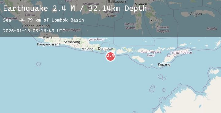
A 2.4 magnitude earthquake struck on South of Bali, Indonesia, at Fri, 16 Jan 2026 08:16:43 GMT. Depth: 32.141918km. Reviewed by BMKG seismologists, this minor quake occurred at a magnitude type of M.
Magnitude
2.4
M
Source
BMKG
Intensity
-
Agency Reports
1 Sources| Source | Magnitude | Depth | Time |
|---|---|---|---|
| BMKGPrimary | 2.4 | 32 km | 2 hours ago |
Earthquake Details
AutomaticEvent IDbmg2026bcay
Tsunami PotentialNo
Magnitude TypeM
Nearest Places
- Lombok Basin44.7 km
- Pulau Sophialouisa58.1 km
- Gili Sarangburung60.8 km
- Tanjung Panggang61.0 km
- Gili Luah61.6 km
Comments
Join the discussion about this event.
Latest Earthquakes
3.5Mag
West Papua Region, Indonesia
Time2 hours ago
Depth14.52 km
SourceBMKG (Automatic)
3.4Mag
SOUTHERN ITALY
Time2 hours ago
Depth270.10 km
SourceINGV (Automatic)
3.1Mag
MYANMAR
Time2 hours ago
Depth10.00 km
SourceTSB (Automatic)
1.6Mag
32 km N of Searles Valley, CA
Time2 hours ago
Depth4.88 km
SourceUSGS (Automatic)
3.1Mag
SAN JUAN, ARGENTINA
Time2 hours ago
Depth108.00 km
SourceNSNA (Automatic)
Nearby Earthquakes
No significant earthquakes nearby recently.