Earthquake Timor Region
Fri, 16 Jan 2026 17:56:47 GMT
Time4 hours ago
Location
-8.7444, 124.4084
Depth
86.8 KM
Event Summary
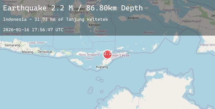
A 2.2 magnitude earthquake struck on Timor Region, at Fri, 16 Jan 2026 17:56:47 GMT. Depth: 86.801392km. Reviewed by BMKG seismologists, this minor quake occurred at a magnitude type of M.
Magnitude
2.2
M
Source
BMKG
Intensity
-
Agency Reports
1 Sources| Source | Magnitude | Depth | Time |
|---|---|---|---|
| BMKGPrimary | 2.2 | 87 km | 4 hours ago |
Earthquake Details
AutomaticEvent IDbmg2026bcub
Tsunami PotentialNo
Magnitude TypeM
Nearest Places
- Tanjung Keltetek31.7 km
- Tanjung Parilal31.7 km
- Tanjung Margeta31.7 km
- Tanjung Gemuk31.8 km
- Teluk Tebakomi32.0 km
Comments
Join the discussion about this event.
Latest Earthquakes
2.9Mag
Timor Region
Time5 hours ago
Depth1.88 km
SourceBMKG (Automatic)
2.2Mag
Flores Region, Indonesia
Time5 hours ago
Depth84.07 km
SourceBMKG (Automatic)
2.5Mag
Seram, Indonesia
Time5 hours ago
Depth19.26 km
SourceBMKG (Automatic)
3.3Mag
Southern Sumatra, Indonesia
Time5 hours ago
Depth69.05 km
SourceBMKG (Automatic)
2.9Mag
OFFSHORE BIO-BIO, CHILE
Time5 hours ago
Depth26.60 km
SourceCSN (Automatic)
Nearby Earthquakes
No significant earthquakes nearby recently.