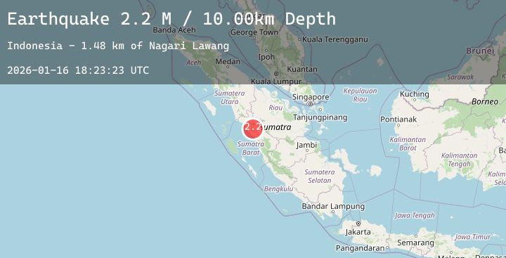
Earthquake Southern Sumatra, Indonesia
Fri, 16 Jan 2026 18:23:22 GMT
Time2 hours ago
Location
-0.2296, 100.2755
Depth
5.0 KM
Event Summary
A 2.2 magnitude earthquake struck on Southern Sumatra, Indonesia, at Fri, 16 Jan 2026 18:23:22 GMT. Depth: 5km. Reviewed by BMKG seismologists, this minor quake occurred at a magnitude type of M.
Magnitude
2.2
M
Source
BMKG
Intensity
-
Agency Reports
1 Sources| Source | Magnitude | Depth | Time |
|---|---|---|---|
| BMKGPrimary | 2.2 | 5 km | 2 hours ago |
Earthquake Details
AutomaticEvent IDbmg2026bcuy
Tsunami PotentialNo
Magnitude TypeM
Nearest Places
- Kampungtabu2.2 km
- Nagari Tigo Balai2.8 km
- Bering2.9 km
- Nagari Baringin3.0 km
- Subarang3.9 km
Comments
Join the discussion about this event.
Latest Earthquakes
2.3Mag
Sumba Region, Indonesia
Time2 hours ago
Depth4.50 km
SourceBMKG (Automatic)
2.2Mag
Timor Region
Time2 hours ago
Depth86.80 km
SourceBMKG (Automatic)
0.9Mag
WESTERN TURKEY
Time2 hours ago
Depth6.90 km
SourceAFAD (Automatic)
5.2Mag
WESTERN INDIAN-ANTARCTIC RIDGE
Time3 hours ago
Depth10.00 km
SourceNEIC (Automatic)
2.9Mag
Timor Region
Time3 hours ago
Depth1.88 km
SourceBMKG (Automatic)
Nearby Earthquakes
No significant earthquakes nearby recently.